AI Landscape Modelling
We have developed a landscape modelling tool for viewing the local or regional landscape, modifying it virtually and then modelling the impact of those changes. The tool relies on machine learning and computer vision models for the automatic characterisation of land use at scale as well as conventional modelling approaches for examining the impact of change.
The widespread acceptance of machine learning support in the decision-making process will require an advanced understanding of end-users and their interaction with this technology. We continually evolve the landscape modelling tool to address three major usability issues: how should the system (i) explain its predictions/advice to end-users, (ii) enable optimal decision-making, and (iii) foster trust and acceptance.
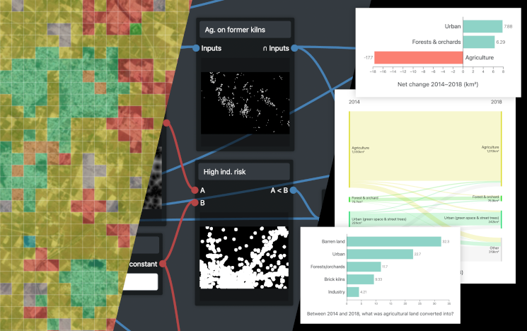
In the Inclusive Green Infrastructures for Urban Well-Being project funded by the British Academy, we use the landscape modelling tool to explore the changes that have taken place in peri-urban and their impacts on green infrastructure and well-being by focusing specifically on the livelihoods of farmers. The project comprises the groups of Fiona Marshall (Science Policy Research Unit, University of Sussex, PI), Novi Quadrianto and Jeremy Reffin (Predictive Analytics Lab, AI research group in Informatics), and collaborators from Zhongnan University of Economics and Law (China) and Jawaharlal Nehru University (India).