 Morija site May 1950
Topographic maps and aerial photography exists from 1950 to present for all sites. The photographs are being digitalized and geo-referenced. A series of overlay maps and data sets will be constructed using Google Earth as a base.
As data are collected in the field, they will be integrated into the maps. At the end of the project, historical and bio-physical data will be integrated into the map base. This work is being carried out at the Department of Geography, University of Sussex.
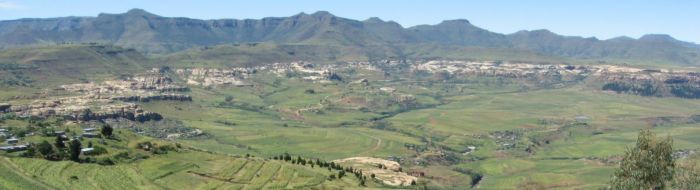
 Morija site 2005 - Google Earth
The purpose of the geographical representations is to provide a spatial framework for the analysis so that the detailed work on the individual sites can be placed in a broader framework of the Lesotho landscape. The availability of the air photos and the fortunate fact that all but one of the sites is represented by high resolution data on Google Earth means that we are able to examine the biophysical relationships present at each site and link these through to the historical data derived from the surveys. The detail available from 'community walks', which will have GPS georeferencing, can help us highlight very specific features that link with the biophysical landscape. Finally, it is proposed to produce a database on all known woodlot sites (many were mapped on a 1:50000 series) and investigate the extent to which the results of former planting activity can be observed.