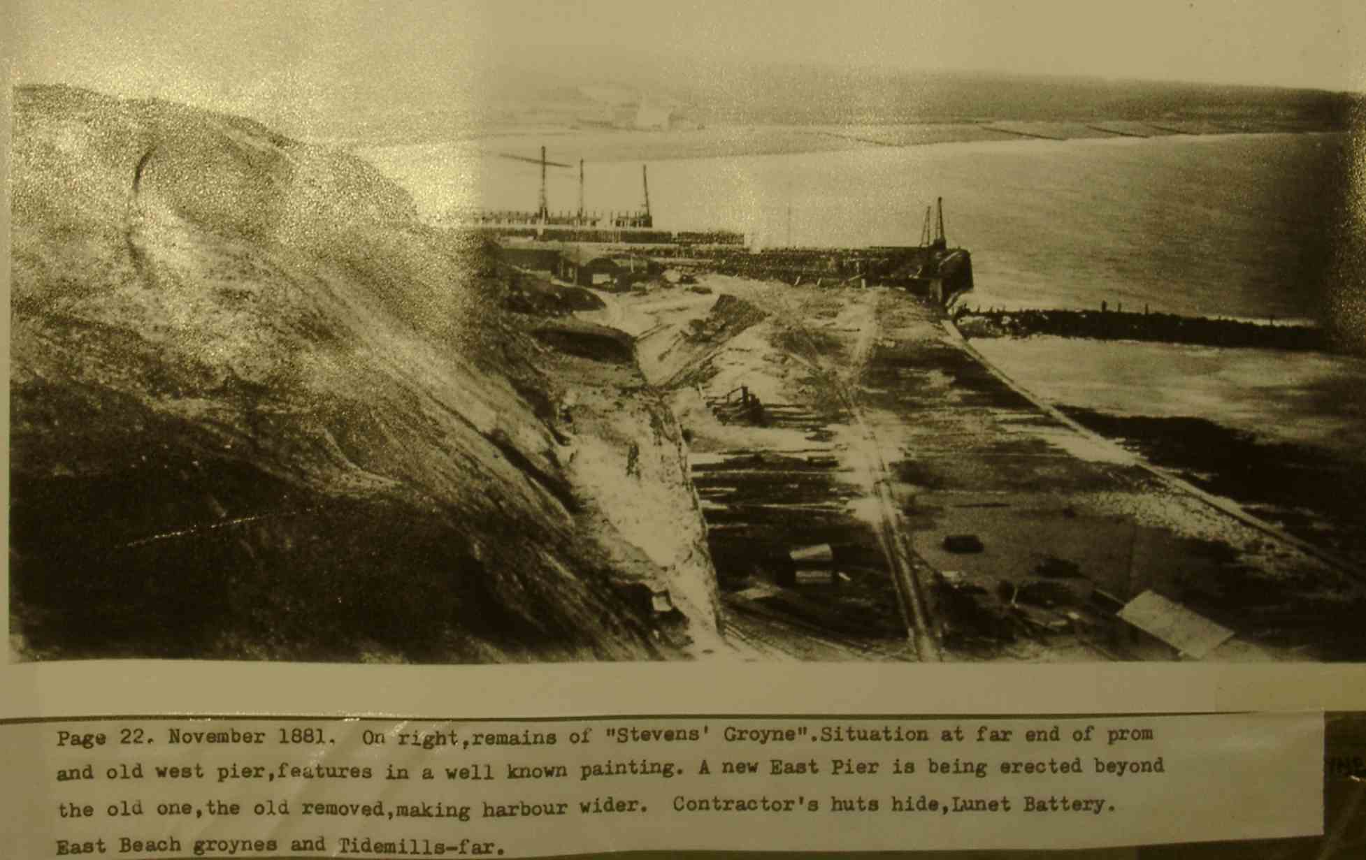
November 1881. View eastwards from the top of the former sea cliffs, showing engineering works in progress to improve the harbour entrance.
November 1881. View eastwards from the top of the former sea cliffs, showing engineering works in progress to improve the harbour entrance. |
|
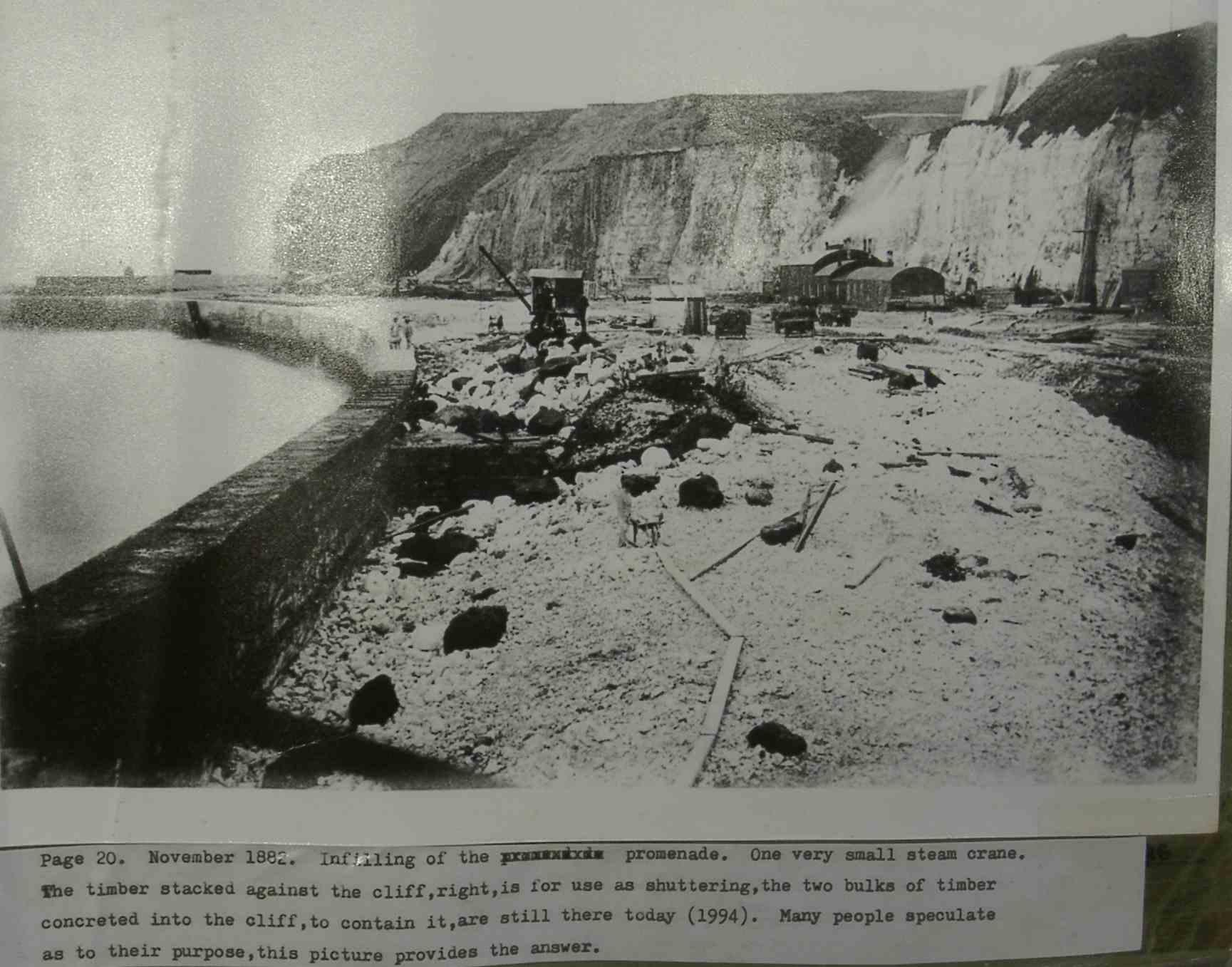
The west side of Newhaven harbour in 1882. Infilling is taking place between the former sea cliffs and the new harbour wall in order to raise the ground surface. The material for infilling was mainly taken from the cliffs behind. |

|
One hundred and twenty years later, in 2002. Engineering work is going on to try to stabilise the old sea cliffs, which are suffering weathering and erosion despite being protected from the sea. Note the build-up of talus at the foot of the cliffs. The dark strata overlying the chalk are clays and sands of Tertiary age. The clays are prone lanslipping in wet weather. |
| In 1879 the landward end of the new western breakwater or "harbour arm" had been finished. This photograph from the cliff top was taken when the tide was low, exposing the chalk shore platform. | 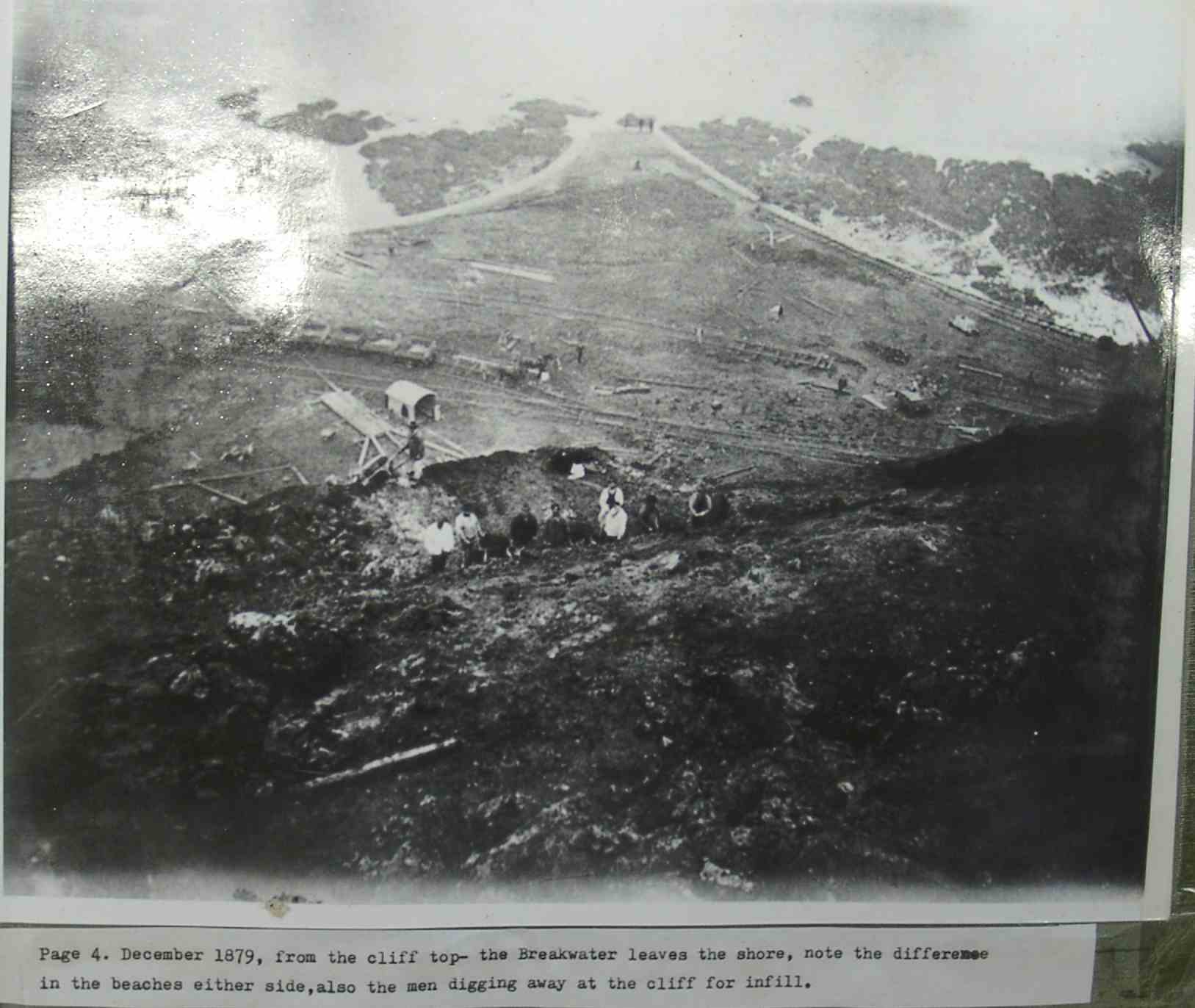 |
| By 1882-3, the breakwater extended well seawards with the shore platform still plainly visible at low water | 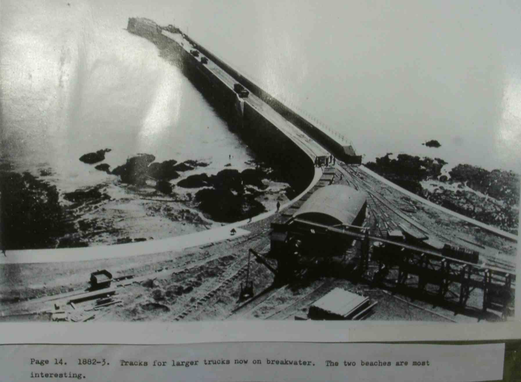 |
| The view in July 2002. The breakwater traps all eastward moving shingle on its western side as an ever-growing accumulation. A large sandy beach has developed within the harbour basin, but was largely covered by the tide when this photograph was taken. I | 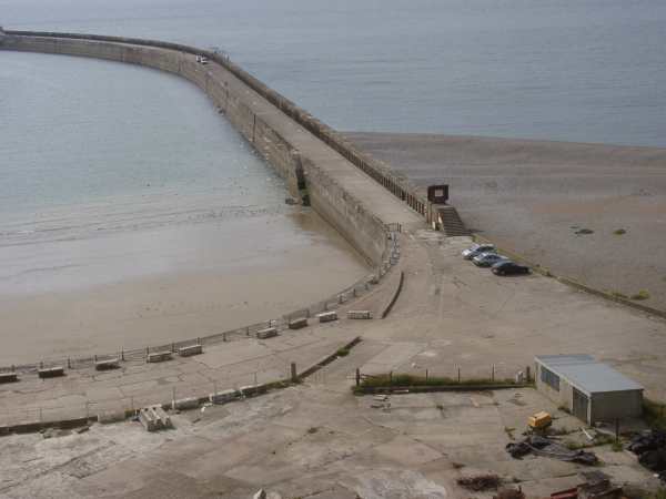 |
 Move the mouse over this image taken in 1932 to see the changes in the shingle beach over the last 70 years. |
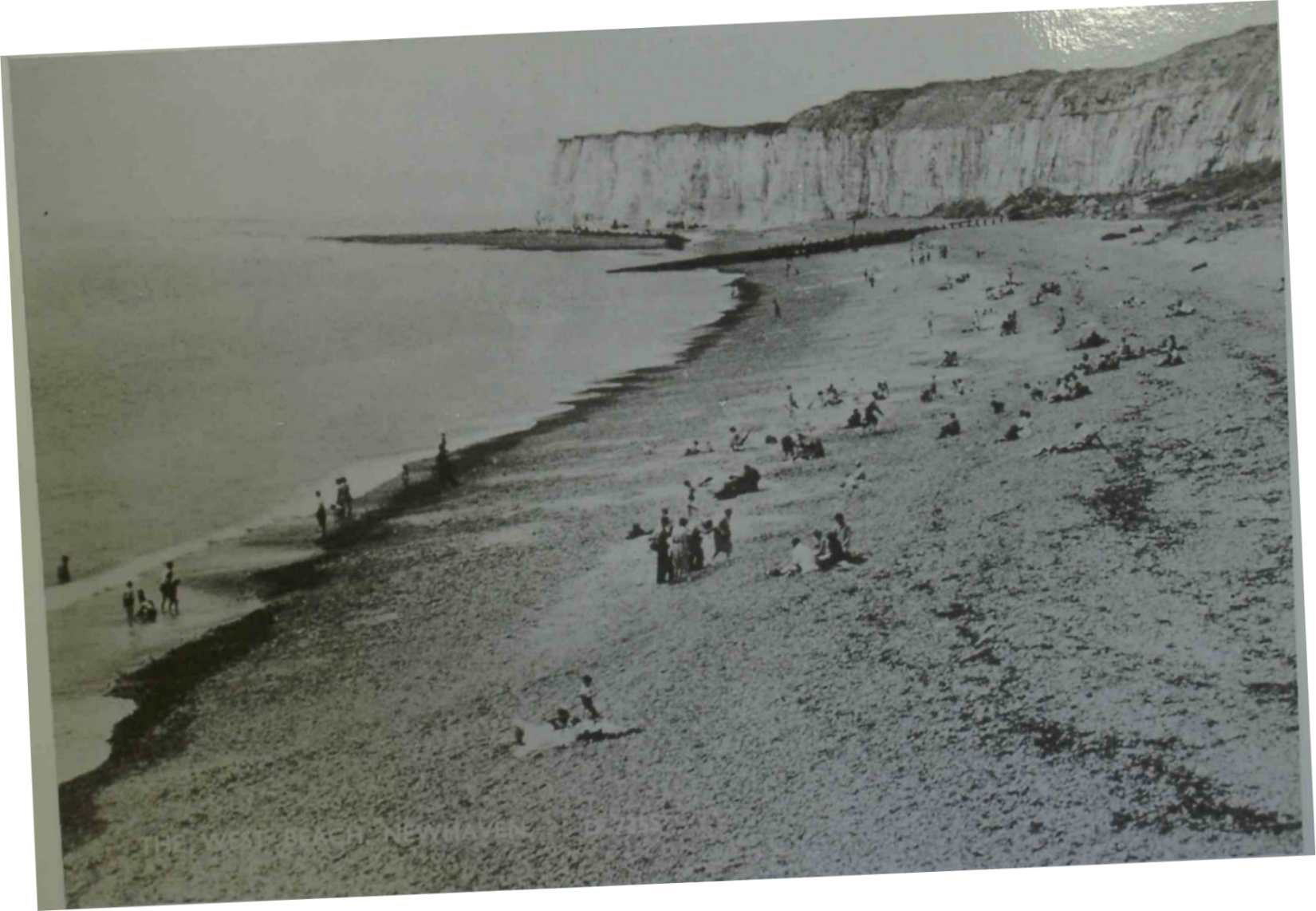
| The West Beach in 1891 showing shingle accumulation starting at the landward end of the breakwater. The black material covering the upper part of the shingle beach is likely to be seaweed marking different strandlines. See also the newspaper article about the photograph. | 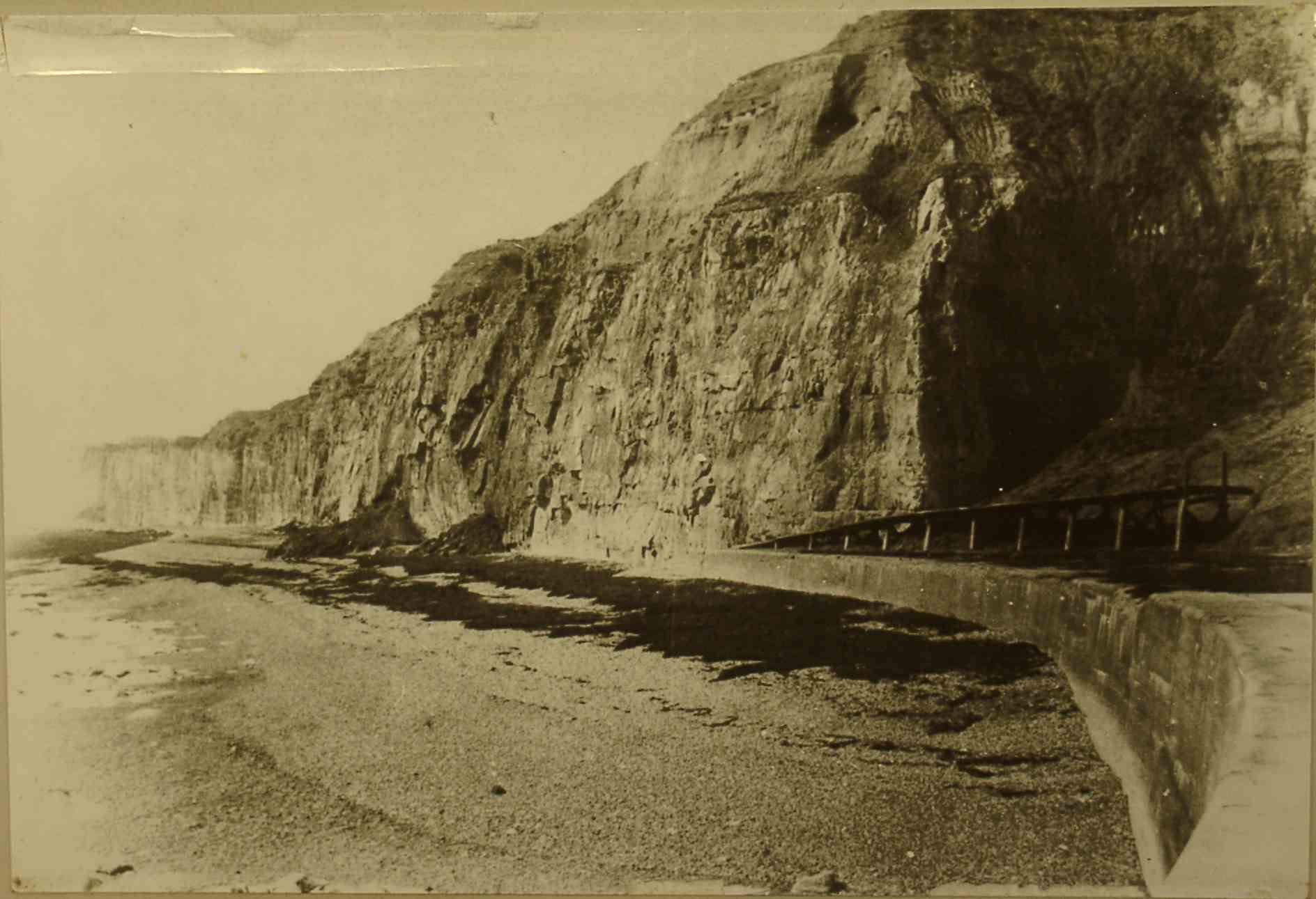 |
| In this photograph from July 2002 the beach has increased to bury the seawall. Slumping of the Tertiary clays capping the chalk has produced a debris apron from coalescing debris cones. Slumps still occur at present under very wet condition. | 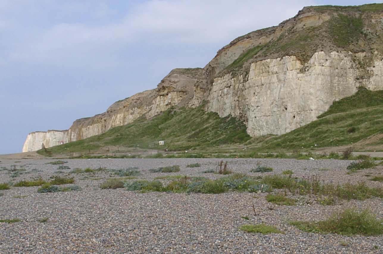 |
 Move the mouse over this image taken in the 1950s to see the changes in the shingle beach over the last 50 years. |