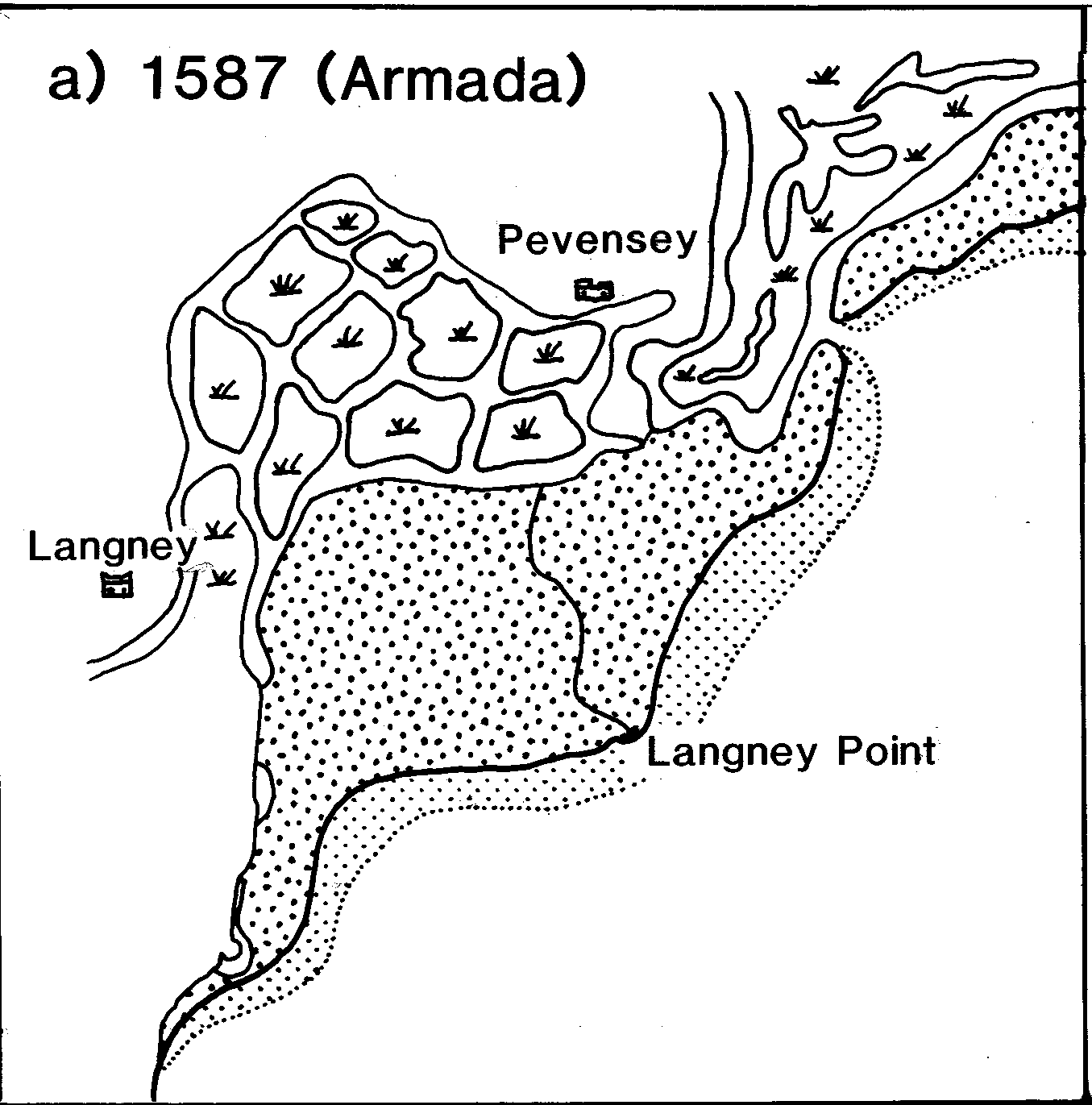
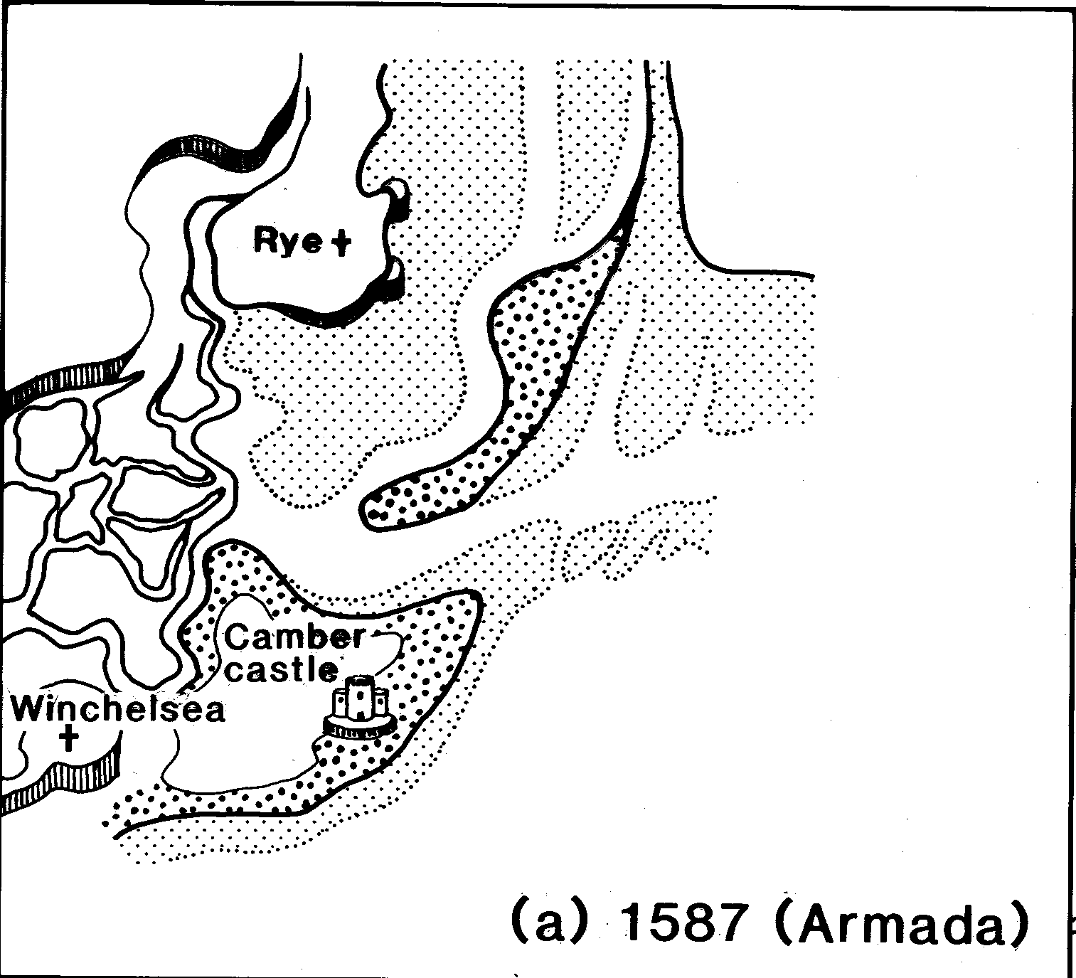
Changes in the Sussex estuaries and at Langney Point illustrated in maps going back to 1587
The texts and maps accessible from this page have been taken from a manuscript produced in 1987 by Peter Rothman as part of the Community Programme project in association with the Geography Faculty at the University of Sussex financed by the Manpower Services Commission. It was intended as a 'Geographical Educational Material for Schools' and was edited by D.A. Robinson.
Unfortunately the manuscript did not reach the publication stage. The manuscript has been been scanned and changes noted in the manuscript have been incorporated. The maps, originally drawn by hand and presented next to each other have been scanned and are now presented in slide shows. Because the last maps used date from the 1980s, modern air photographs have been added as a final slide.
Despite the attempt to redraw the original maps to a common scale, the slide shows illustrate that the maps - and for that matter the air photographs - do not overlay very well. However, the map sequences always show significant changes illustrating the dynamic nature of the coast over the past 400 years. Click on any of the maps below to read about the changes and view a slideshow of maps.
INTRODUCTION
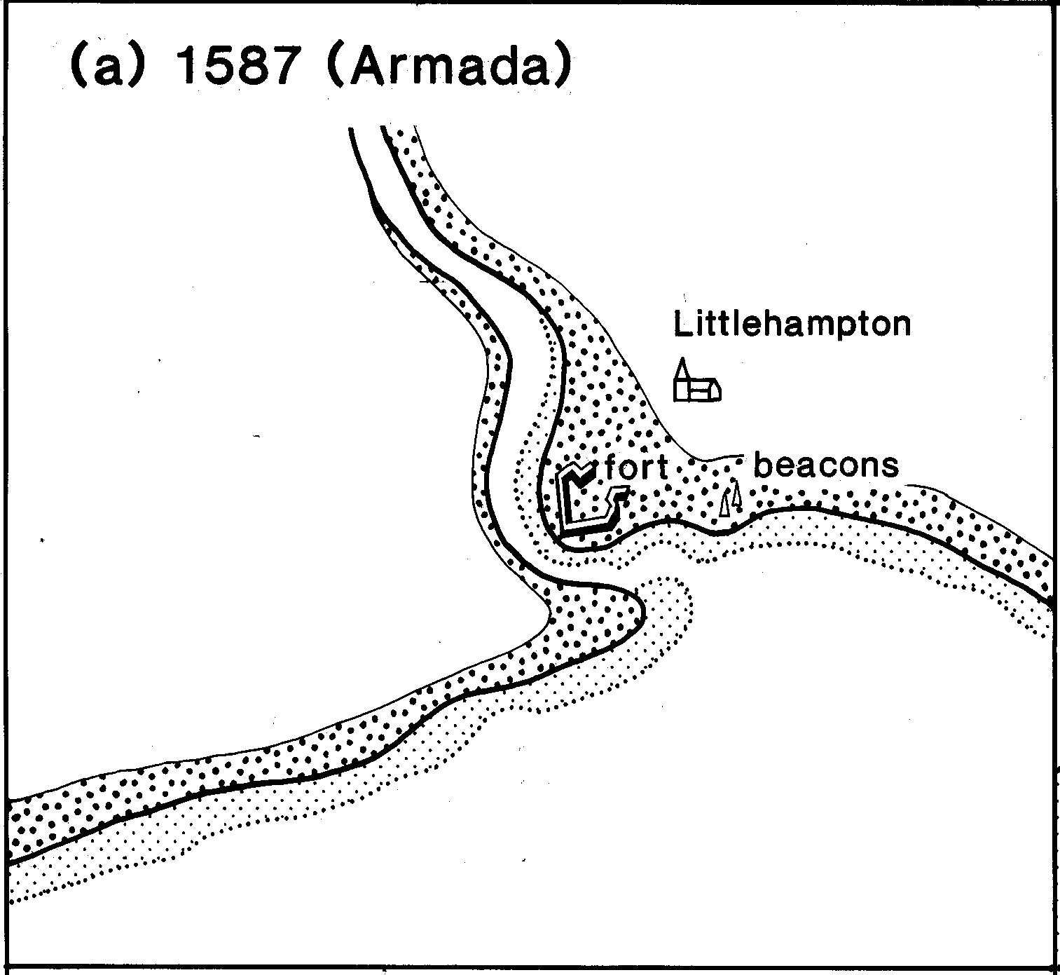
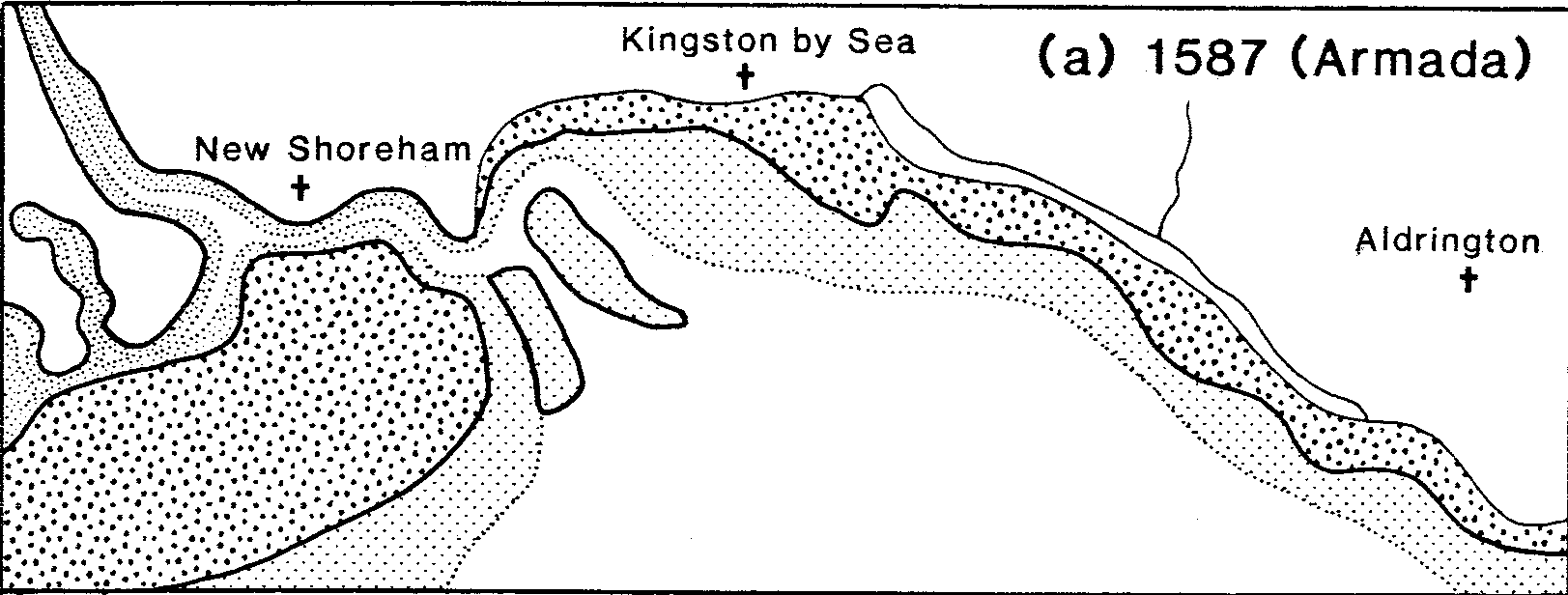
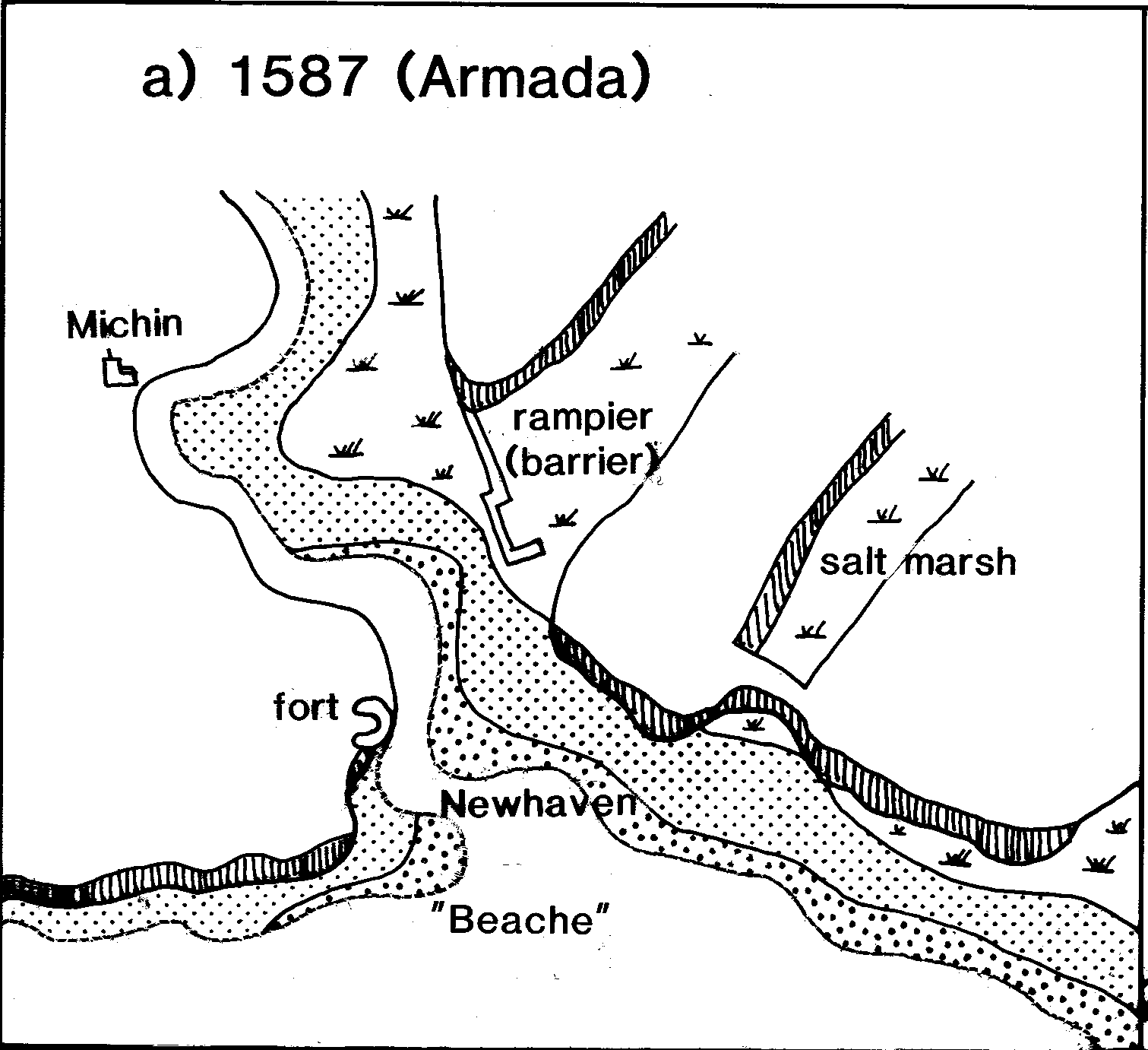
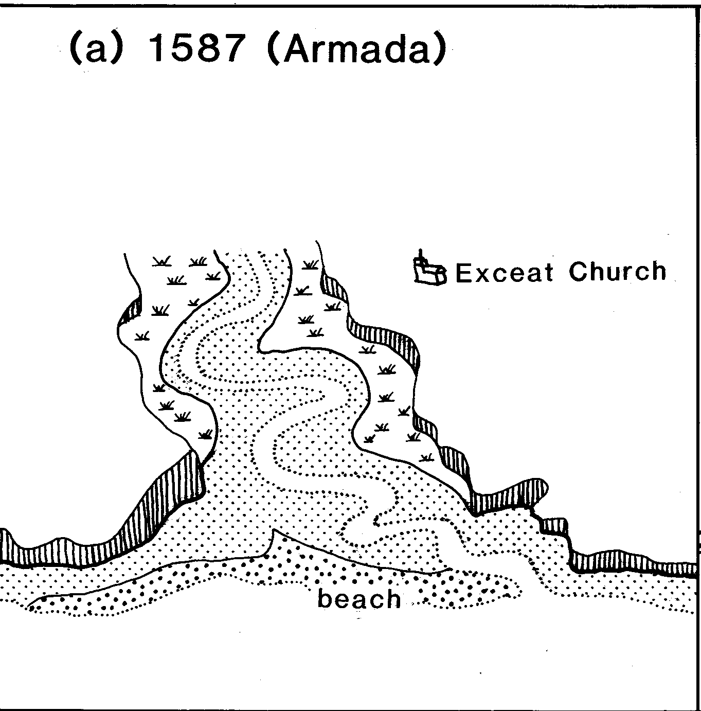
This pack is designed to illustrate, by use of both old and recent maps, some of the changes that have occurred through time to the form estuaries and associated accumulations of shingle along the Sussex coast. The coastline of Sussex has undergone dramatic changes over the past 400 years and these are recorded in both old maps and written documents. Reconstructing these changes is difficult and time consuming because the evidence has to be collected from a variety of scattered sources. The pack commences with a brief introduction to the longer term changes that have affected the Sussex coast and then describes in detail the changes that have occurred at seven sites (Fig.1) in the last 400 years, illustrating the changes by reference to six or eight maps of each site from the Armada Survey of 1587 onwards. In some cases these maps have been simplified by removing some extraneous detail and shading to make the coastal features more prominent, and all have been adjusted as close as possible to the same scale to facilitate direct comparison. The pack may be used simply as a source of data for students to describe and discuss changes visible on the maps, or as a background guide for possible field studies. Most of the sites described in the pack make good locations for field work because evidence of the past courses of rivers and stages in the accumulation of shingle bars are still visible on the ground.
THE POST-GLACIAL HISTORY OF THE SUSSEX ESTUARIES.
During the last Ice Age, sea level around the coast of Britain fell more than l00m below O.D., and in their lower reaches the rivers of Sussex cut deep valleys far below the present day valley floors. When the climate ameliorated in the Post-Glacial period, water locked up as ice on the continents melted and sea level rose. Silts and muds were deposited in the lower reaches of the valleys of the Sussex and in some localities poor drainage resulted in the build up of peat. Some 3000 years ago sea level reached approximately its present level and those lower parts of the valleys which had not yet been infilled by river sediments, were invaded by the sea to form shallow rias. Marine sediments were now deposited as well as fluvial sediments as the process of valley infilling continued. Sedimentation was slow for the coastline was still deeply embayed and the wide tidal estuaries of Roman times survived into Norman times. As the estuaries silted and shallowed, shingle began to drift across the mouths of the rivers creating shingle bars which grew from west to east. This impeded the drainage of the lower valleys and made access by boat difficult and hazardous. As a result, man began to modify the river mouths so as to try and improve the seaward discharge of flood waters from inland, and to maintain access to the river estuary ports. Attempts which continue unabated to the present day.