CoastView - Cuckmere Haven

Cuckmere Haven and the Seven Sisters cliffs, viewed from the Coastguard Cottages in about 1920. At this date the mouth of the Cuckmere river was on the east side of the bay, near Haven Brow, the westernmost of the Seven Sisters. Shingle accumulating in the bay had blocked an earlier mouth nearer the Coastguard Cottages.
Beneath the Seven Sisters cliffs there is a narrow but seemingly continuous shingle beach and a wide, shore platform.
The same scene in 2002. The mouth of the Cuckmere is on the west side of the valley, close to the Coastguard Cottages. Hidden from view are the retaining walls that prevent the river from changing the position of its mouth.
The Seven Sisters cliffs have developed pronounced 'buttress roots'. The beach seems less well developed in 1920, but the seaward edge of the shore platform shows much the same pattern of promontories and embayments.
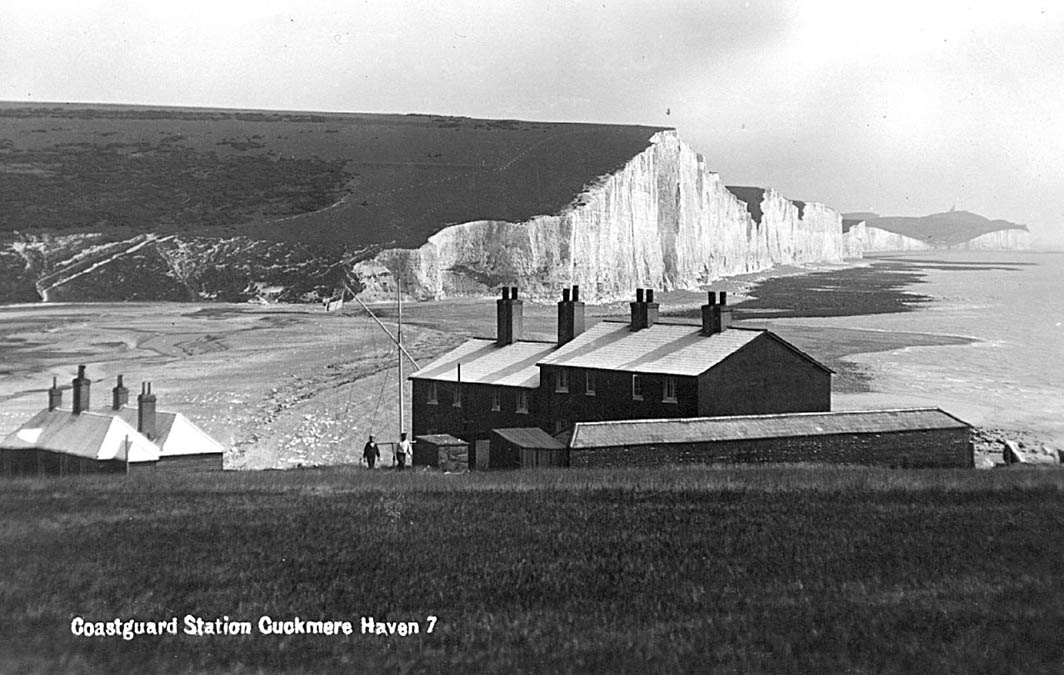
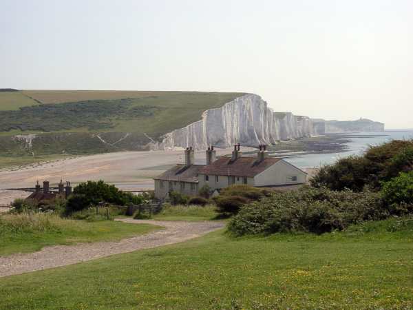
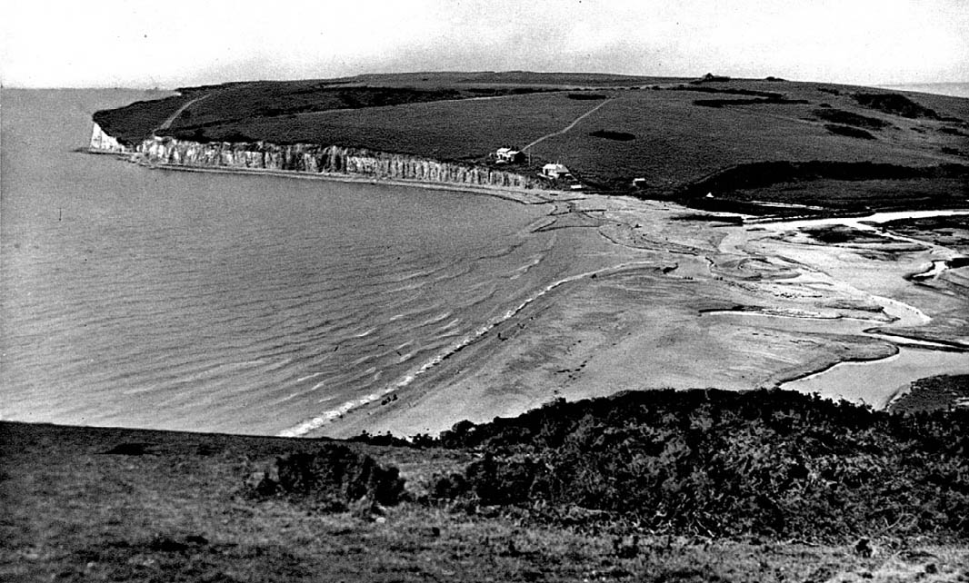
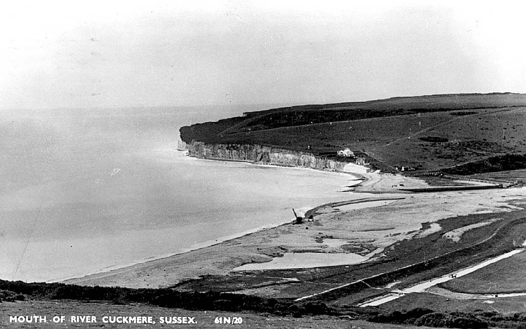
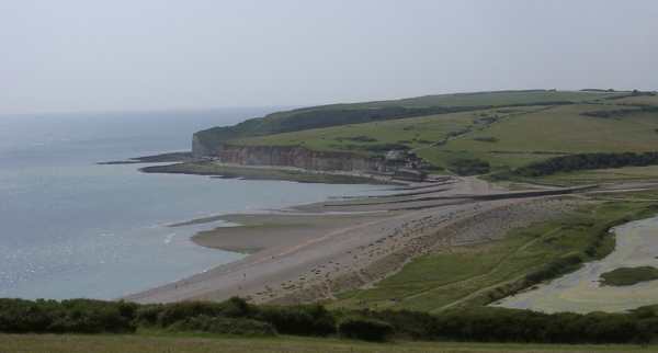
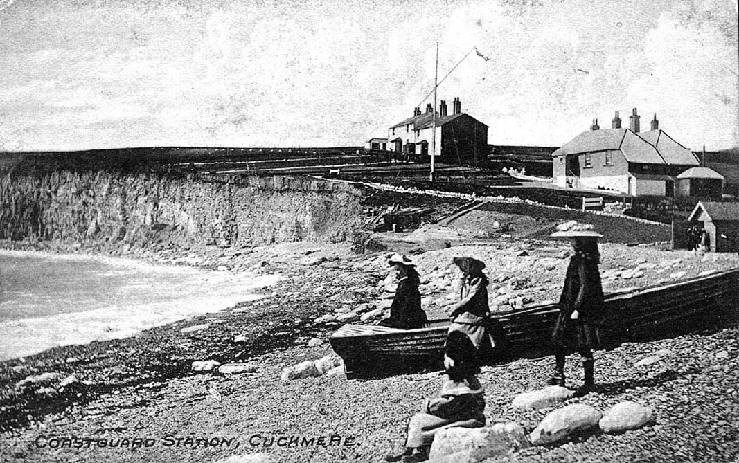
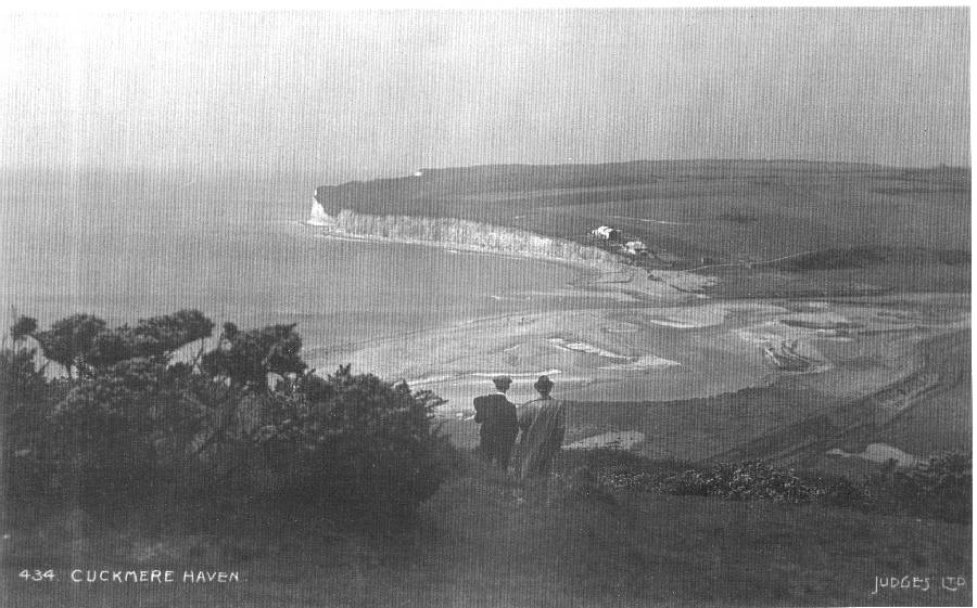
Cuckmere Haven and Seaford Head viewed from Haven Brow, the easternmost of the Seven Sisters in 1907. The photographer was the celebrated Fred Judge of Hastings, who is standing in the foreground with his brother. In the distance are the Coastguard Cottages, which were built well back from the cliff in the 1830s, but by 1907 had become closer to the edge due to cliff erosion by the sea. At the head of the bay are extensive spreads of shingle, transported from beaches further west by the prevailing waves. The Cuckmere River enters the sea through this shingle barrier, following more or less its existing course. Today, the mouth is fixed by massive wooden retaining walls, and is regularly dredged. In 1907, however, the river was allowed to find its own way through the shingle, with occasional help from local farmers, who used horses and ploughs to clear blockages.
Although this postcard is stamped 1948, it might be much older though postdating the one taken in 1907. The Cuckmere is flowing through the shingle barrier still unregulated and the wall/earthbank behind the shingle barrier to hinder any landing gear to be moved further inland during the 2. World War is not present (see next image).
Cuckmere Haven in about 1950. The Coastguard Cottages are now very close to the cliff edge, and the owners have built a short stretch of sea wall to reduce cliff erosion. The river mouth is fixed between wooden retaining walls. Notice the crane on the beach. At this date shingle was being extracted for building purposes.
The view in 2002. A lagoon has been constructed to attract birds. In the zoom-image you can see that the defences beneath the Coastguard Cottages have been enlarged and that the beach next to the Cottages has moved landward. World War 2 tank defences can also be seen.
View from the beach towards the Coastguard Cottages, probably taken in about 1910.
The view today, taken from about the same angle but from the top of a wooden groyne nearly 2.5m above the lower beach, indicating that the beach has moved landward. Notice that the cliff edge has moved nearer to the Coastguard Cottages.
A good comparison of the changes over the last 120 years can be made by looking at the 1st Edition Ordnance Survey map (ORIGINAL SCALE) from 1875 and an air photograph of 1999. The shingle bar that deflected the Cuckmere towards the east extended much further seaward than at present. The cliff erosion in front of the Coastguard Cottages is also well illustrated. Move the mouse cursor over the image to switch between the map and the air photograph.

A good comparison of the changes over the last 120 years can be made by looking at the 1st Edition Ordanance Survey (Scale 1:10560) map from 1875 and an air photograph of 1999. The shingle bar that deflected the Cuckmere towards the east extended much further seaward than at present.
The cliff erosion in front of the Coastguard Cottages is also well illustrated.
Move the mouse cursor over the image to switch between the map and the air photograph


To see the changes at Cuckmere Haven on maps from 1587 to today go to the 'Estuary Section'.