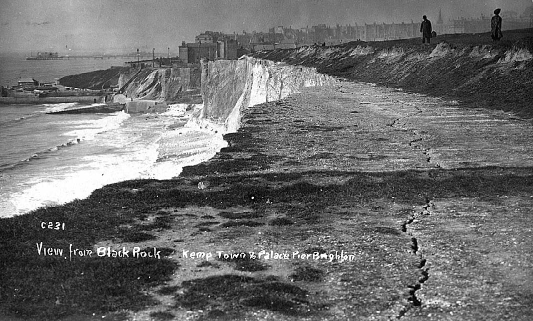
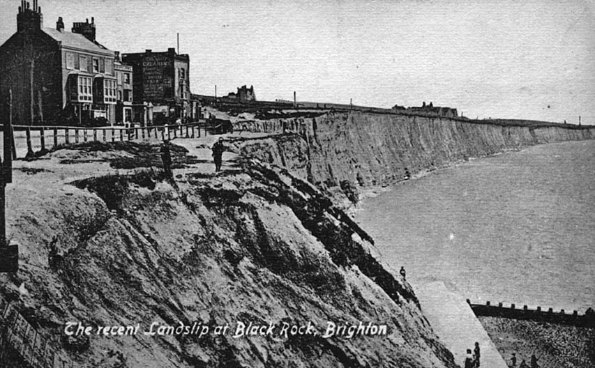
| This photograph taken in about 1909 looks eastwards from Black Rock to beyond Roedean School (skyline, mid distance). Despite the presence of a seawall at Black Rock the cliff has recently fallen, endangering the three buildings on top (the middle one is the Abergavenny Arms) and also the main coast road in front of the buildings, which is somewhat hidden from view. The coast road had to be diverted behind the buildings, which were later demolished. |
 |
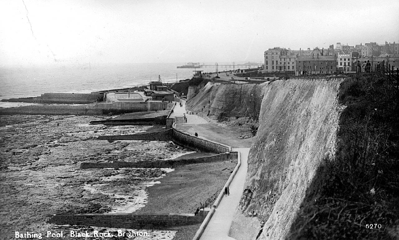
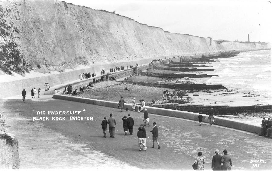
Continuing erosion of the sea cliffs east of Black Rock caused increasing concern in the years following the First World War. In 1930 Brighton Corporation began building a massive sea wall at the base of the cliffs all the way to Rottingdean. An undercliff walkway or promenade was constructed on top. Unemployed Welsh miners were lowered on ropes over the cliffs to trim the faces back to a supposedly safe angle of 75 degrees. The sea wall was completed and the walkway opened in 1933. An extension to Saltdean followed in 1935. |
 |
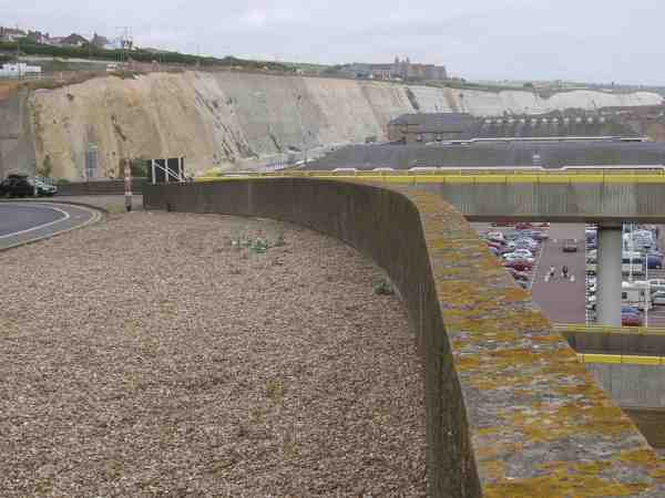
| In the 1960s proposals were put forward to build a Marina and harbour immediately to the east of Black Rock. Years of negotiation with landowners and the planning authorities followed. Construction of the Marina began in the 1970s. It cost Ł41 million, far more than originally estimated, and was opened by the Queen in May 1979 (To see what the Marina looked like in 1978
see a photo taken by kind permission from Newhaven Museum). This photograph shows the Marina approach road in July 2002. Roedean School can be seen in mid distance on the skyline. Taken from almost the same vantage point as the first photograph. |
 |