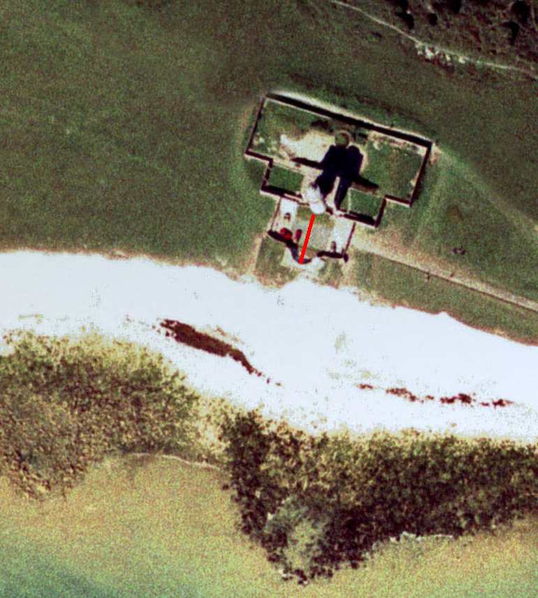
Note also the tongue of blocks on the shore platform from a previous cliff fall.
Airphoto taken from GetMapping archive of East Sussex air photographs located in the Geography Resource Centre at the University of Sussex.
|
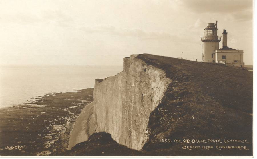
Belle Tout lighthouse from the east in about 1908. |
|
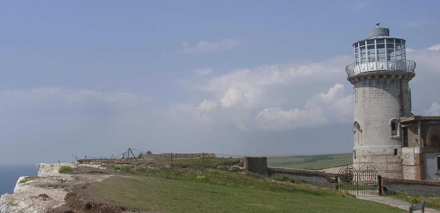
Belle Tout lighthouse from the east in 2002 after the move. The lighthouse appears to be about the same distance from the cliff edge as in 1908, but since then both edge and lighthouse have retreated! |
|
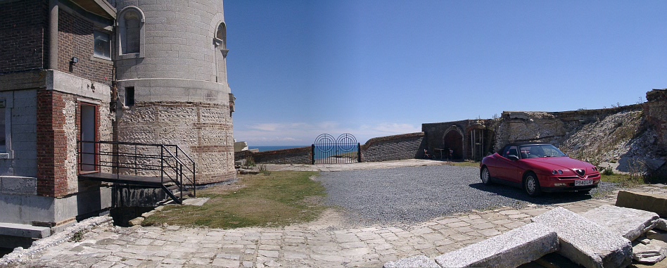
The light house today from the west. Its former position can be clearly seen to the right of the car. |
|
Airphoto taken after the move. The red line shows the distance the lighthouse has moved. Note also the tongue of blocks on the shore platform from a previous cliff fall. Airphoto taken from GetMapping archive of East Sussex air photographs located in the Geography Resource Centre at the University of Sussex. |
| Distant view of Belle Tout lighthouse from the slope leading up to Beachy Head. The year is 1928. | 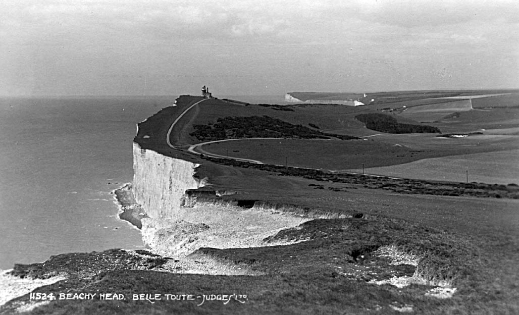 |
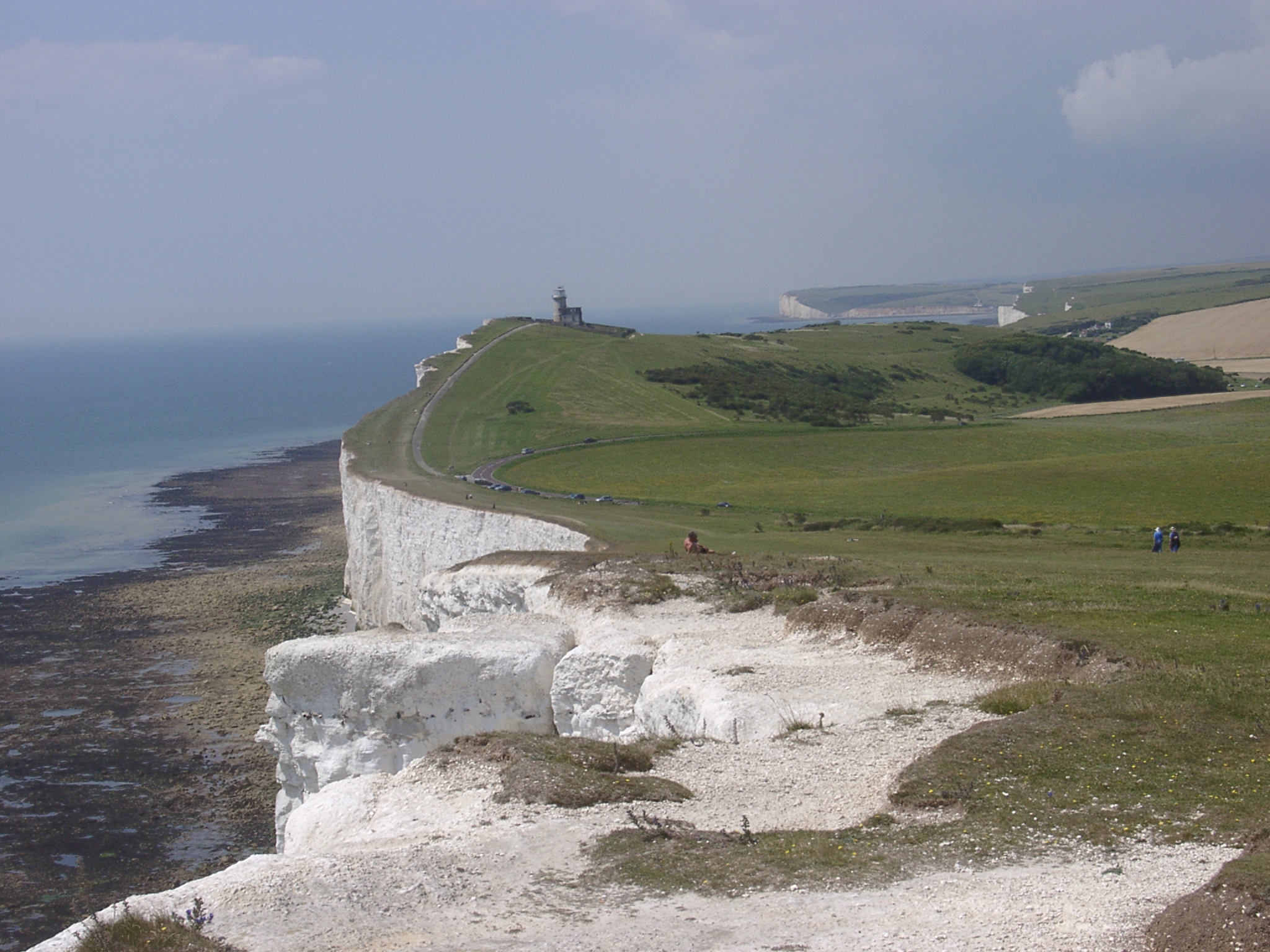
| In this photograph taken in July 2002 the road up to the lighthouse is much nearer to the cliff edge, as a result of erosion over the preceding 74 years. |
 |