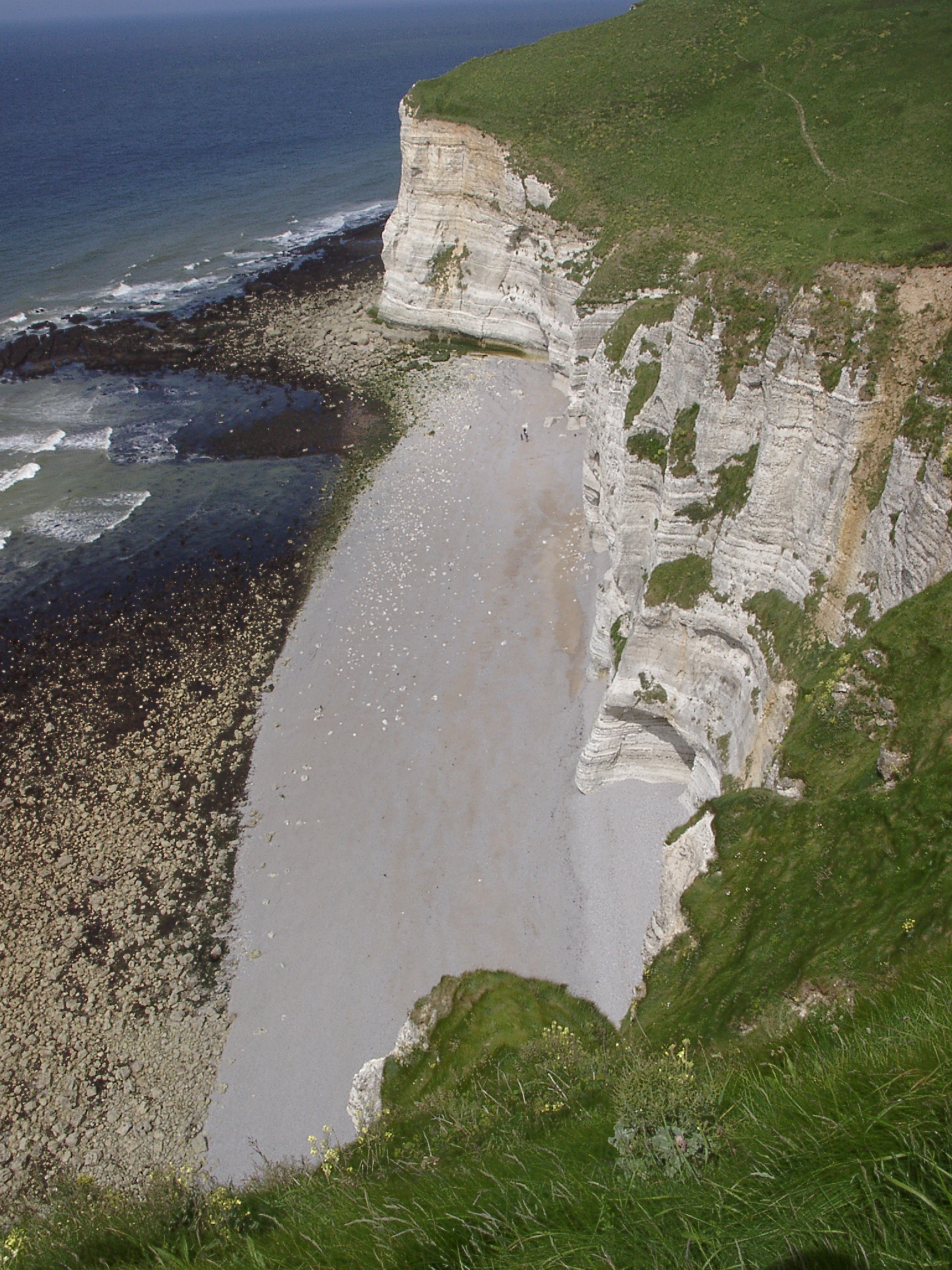
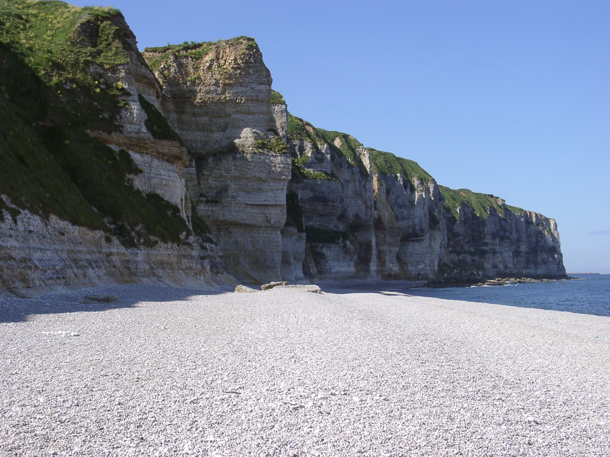
 Beach between Cap d'Antifer and Pointe du Fourquet at the bottom of le Fourquet seen from top of the cliffs |
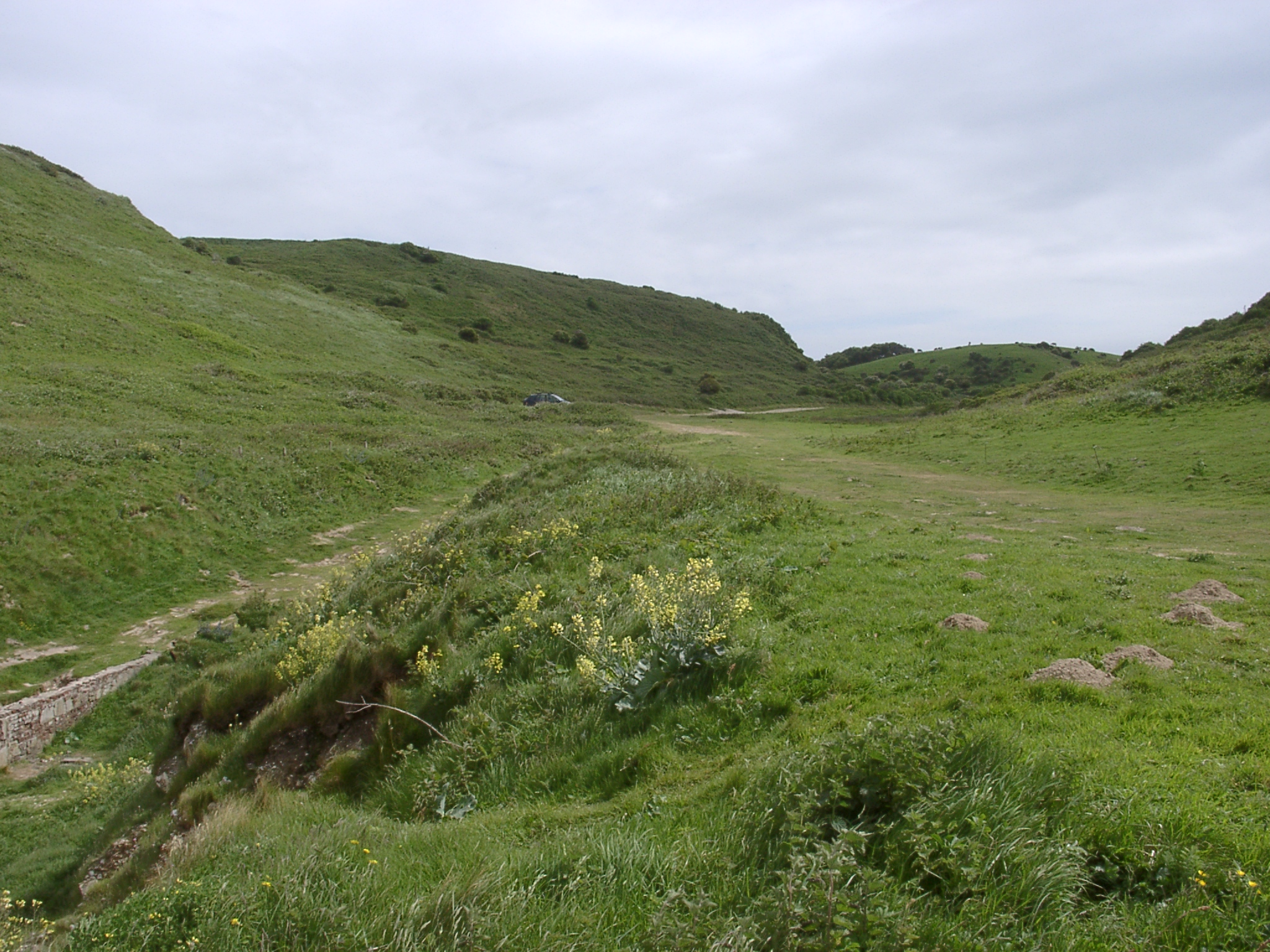 View up the valley of le Fourquet. |
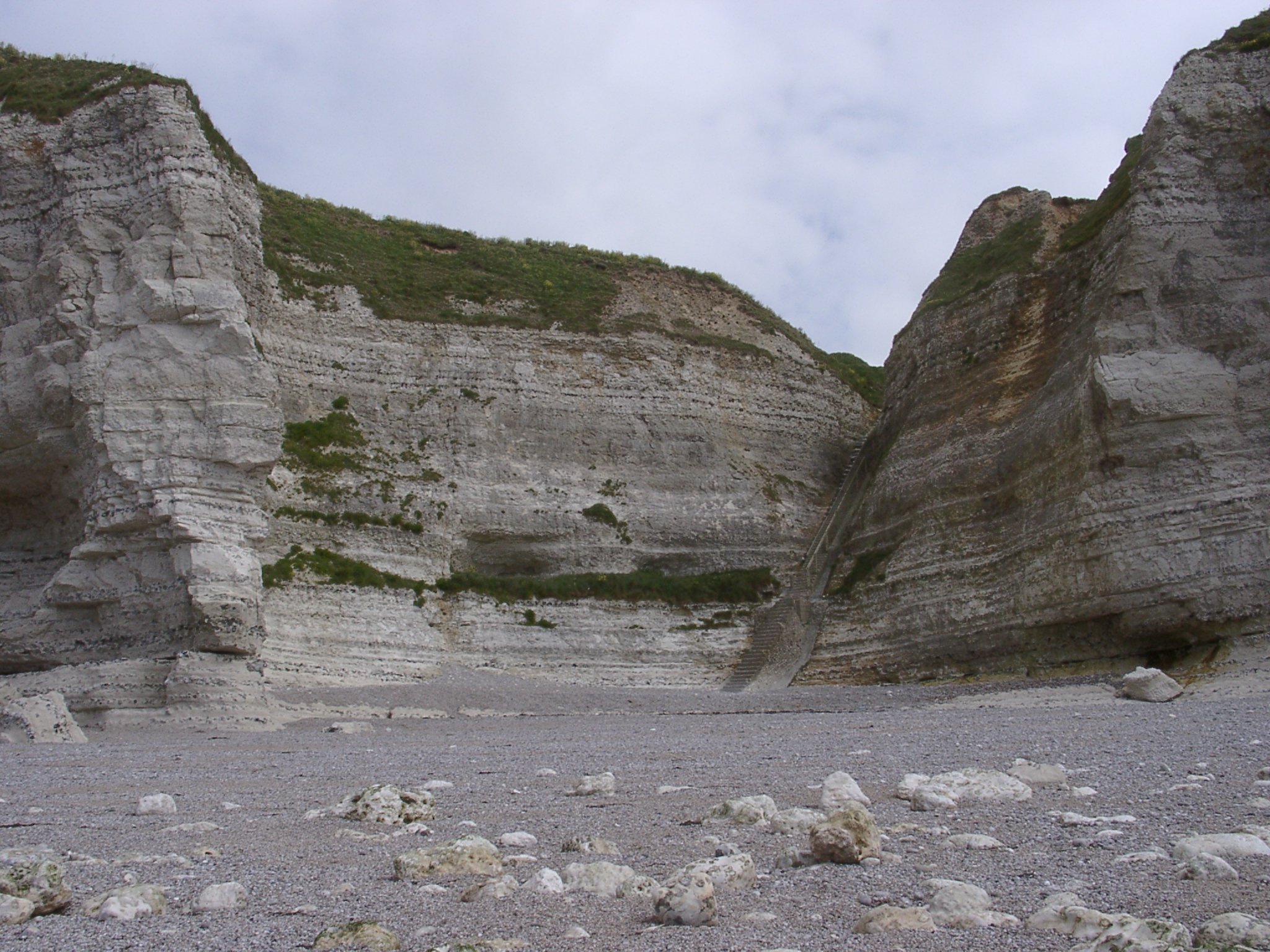 Beach between Cap d'Antifer and Pointe du Fourquet at the bottom of le Fourquet seen from the beach showing access steps. |
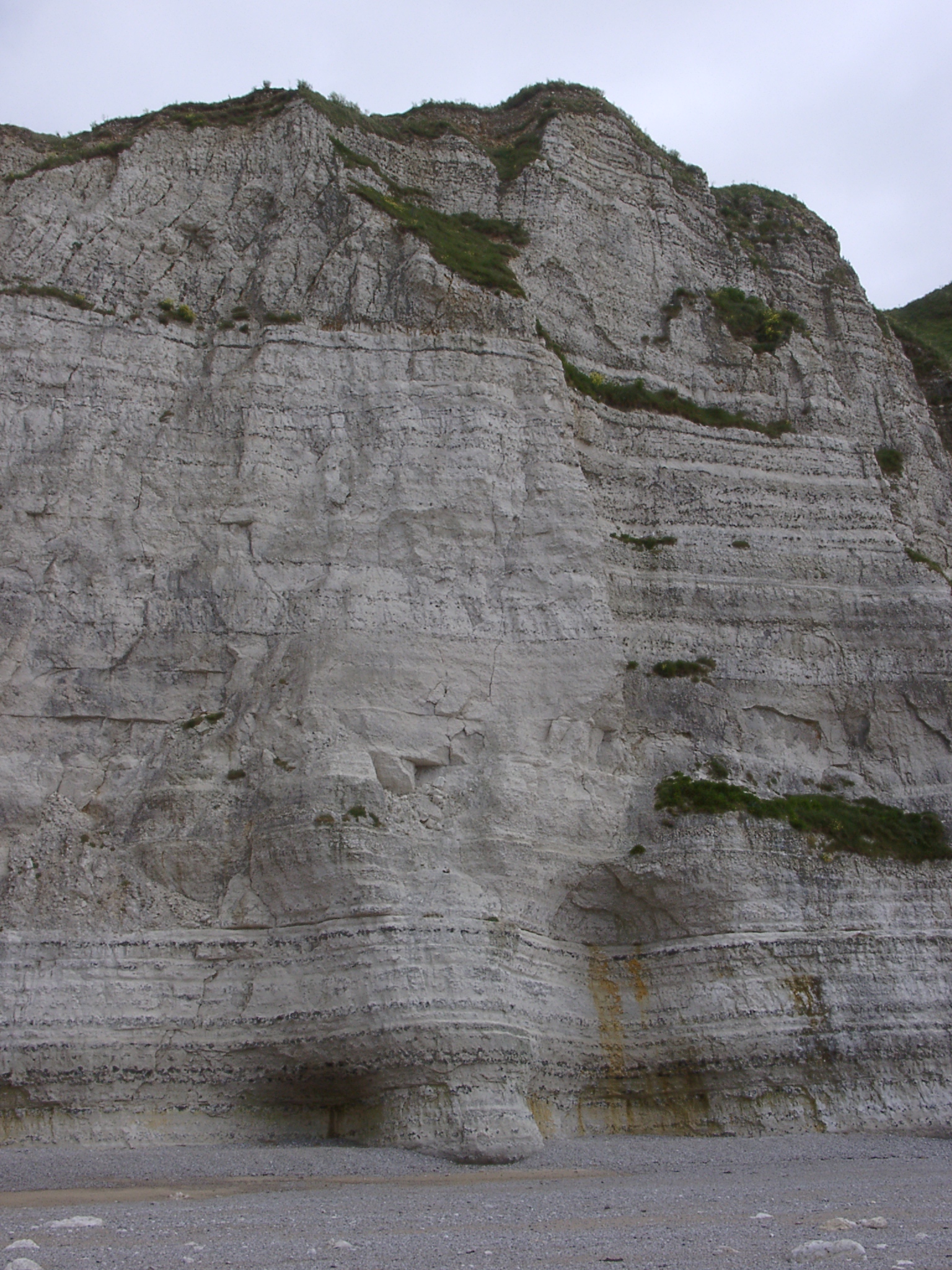 Cliffs behind the beach showing varying distribution of flint in the chalk. |
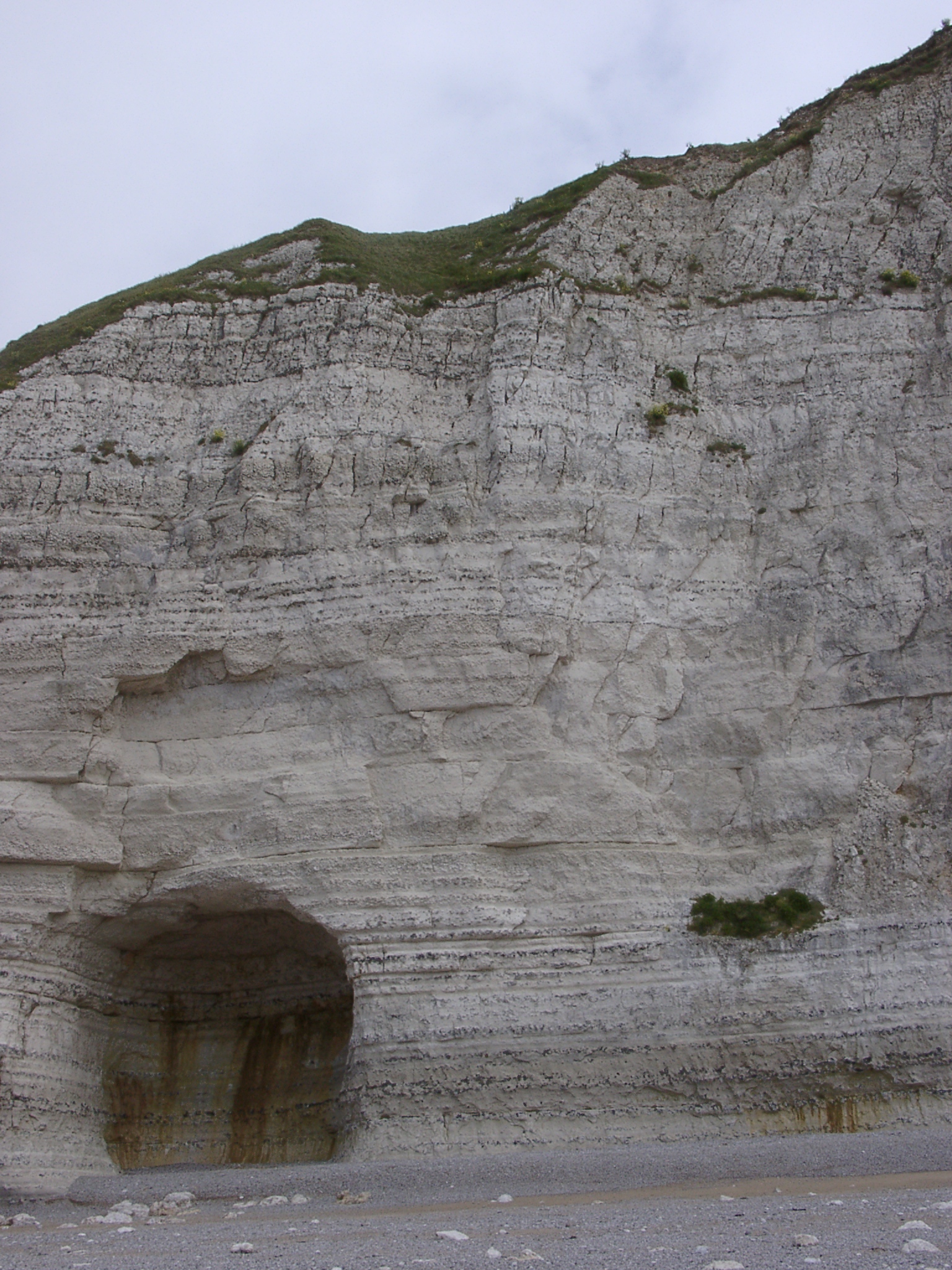 Cliffs behind the beach with cave |
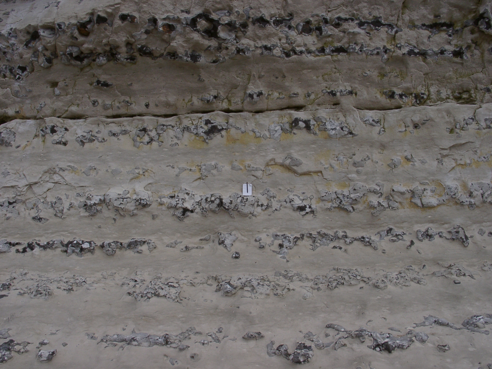 Detail of the lower cliff with massive flint bands. Pen and notebook (15cm high) for scale. |
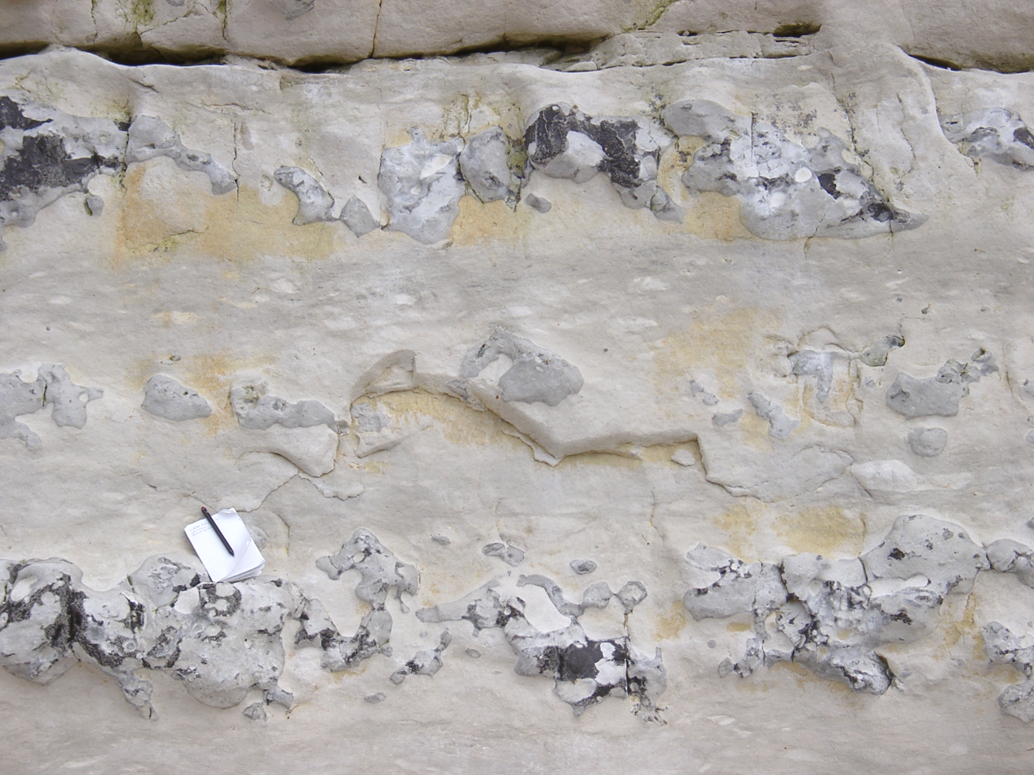 Detail of the lower cliff (detail of the previous photo) with massive flint bands. Pen and notebook (15cm high) for scale. |
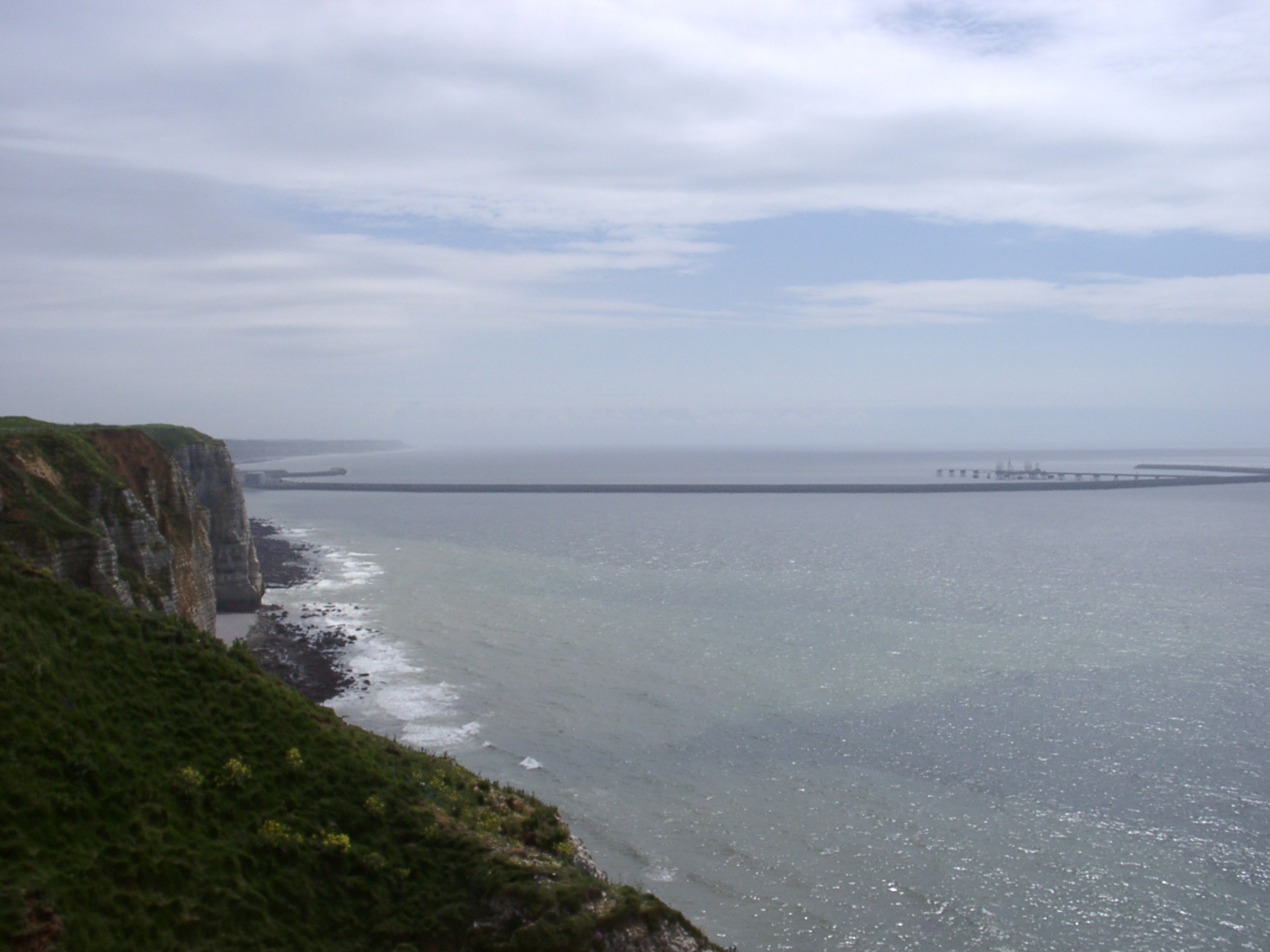 View from Cap D'Antifer south along the cliffs with the harbour arm of the 'Port Pťtroler du Havre-Antifer' in the background extending ~2.5km out to sea. |
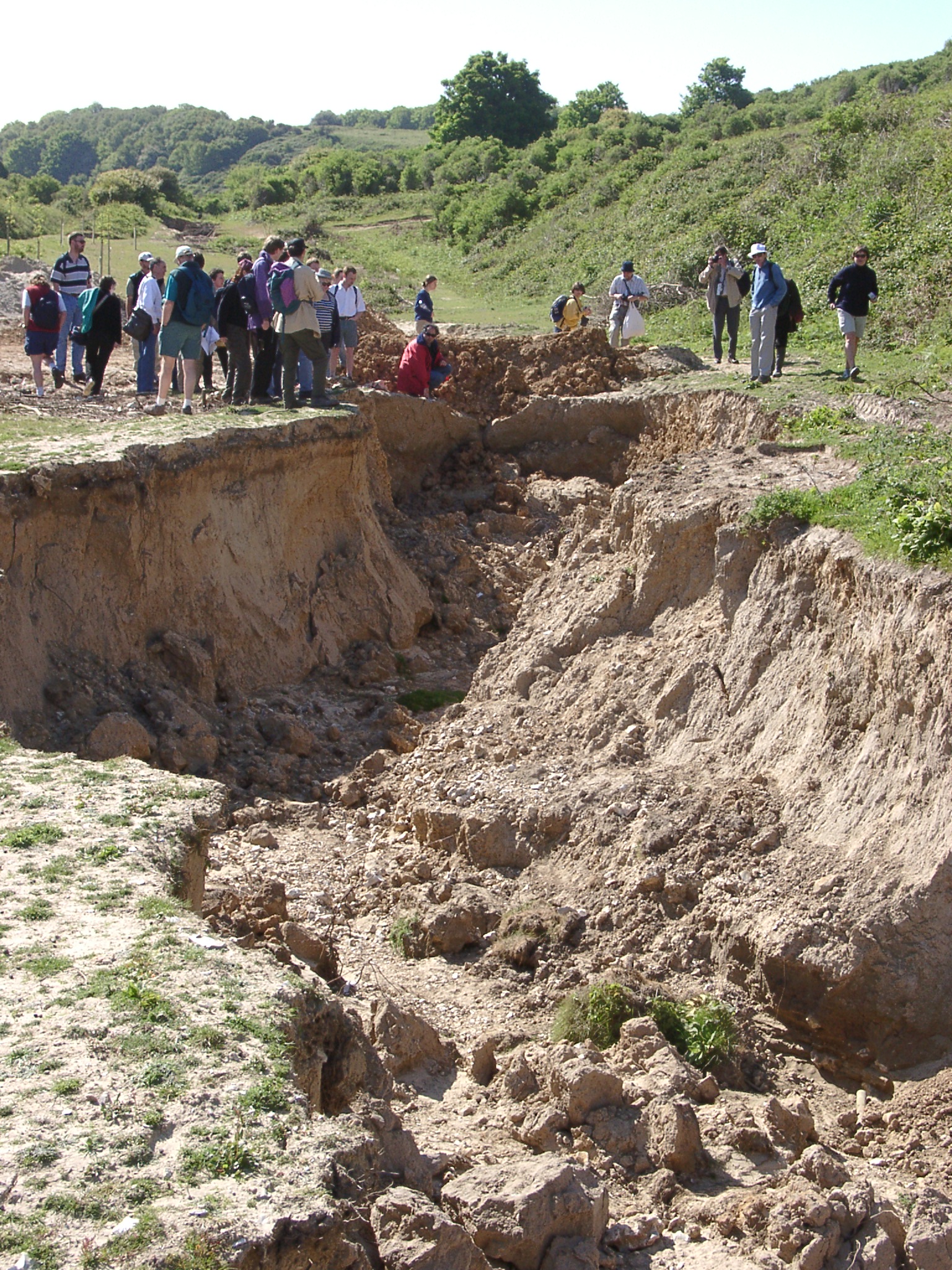 Lower part of the Valleuse d' Antifer showing signs of severe fluvial erosion of the valley infill (looking upvalley towards the start of the incision) |
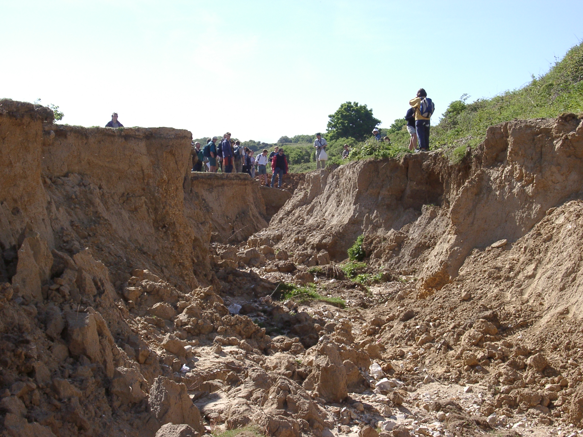 Lower part of the Valleuse d' Antifer showing signs of severe fluvial erosion of the valley infill (looking upvalley towards the start of the incision) |
||
 The cliff foot east of the Valleuse d' Antifer showing smooth sloping lower cliff (notch development attributed to sub-aerial weathering) above a step that is partly covered by shingle in the foreground ('hardground'). | 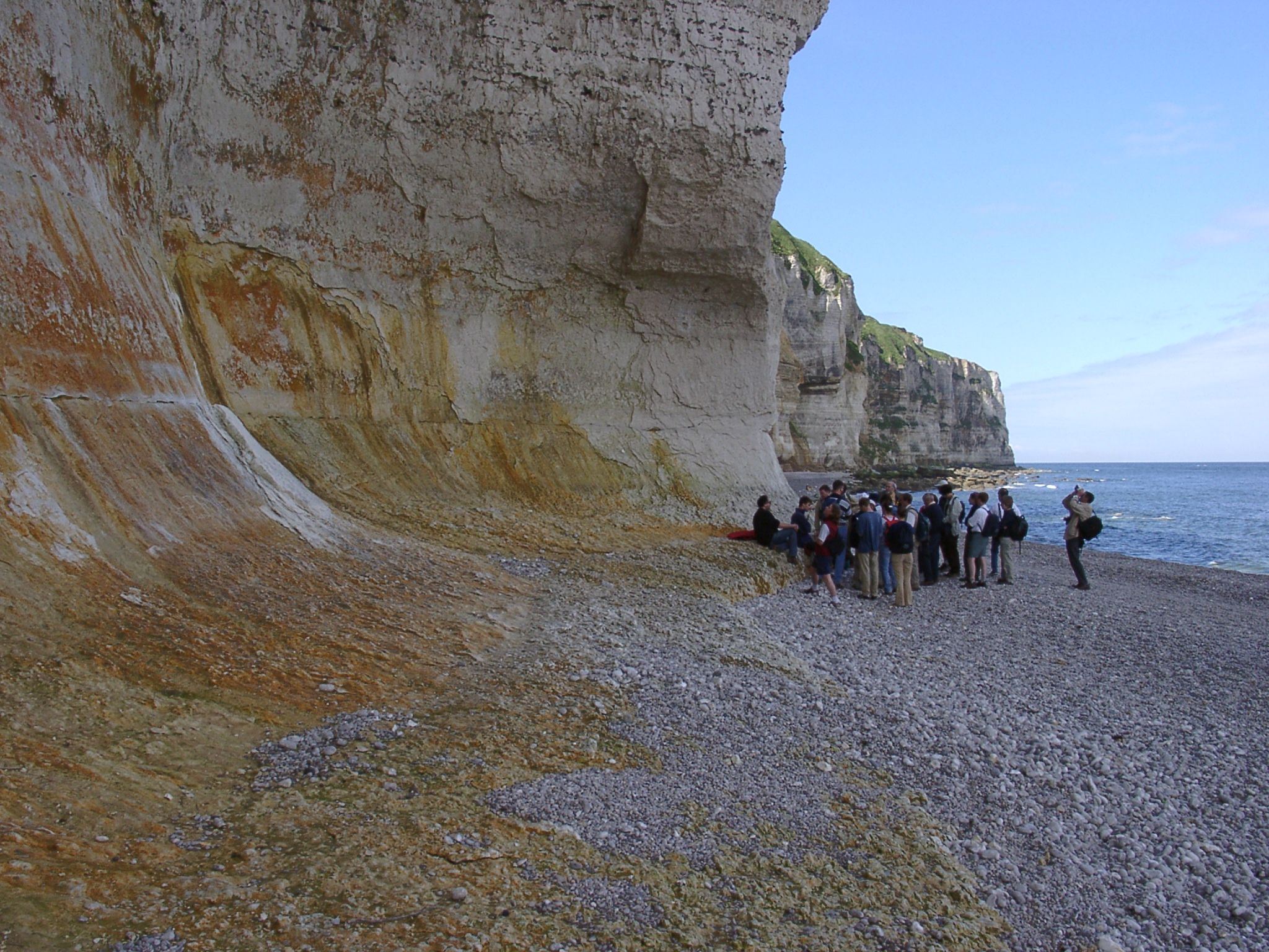 At the cliff foot east of the Valleuse d' Antifer showing smooth sloping lower cliff (notch development attributed to sub-aerial weathering) above a step that is partly covered by shingle in the foreground ('hardground'). |
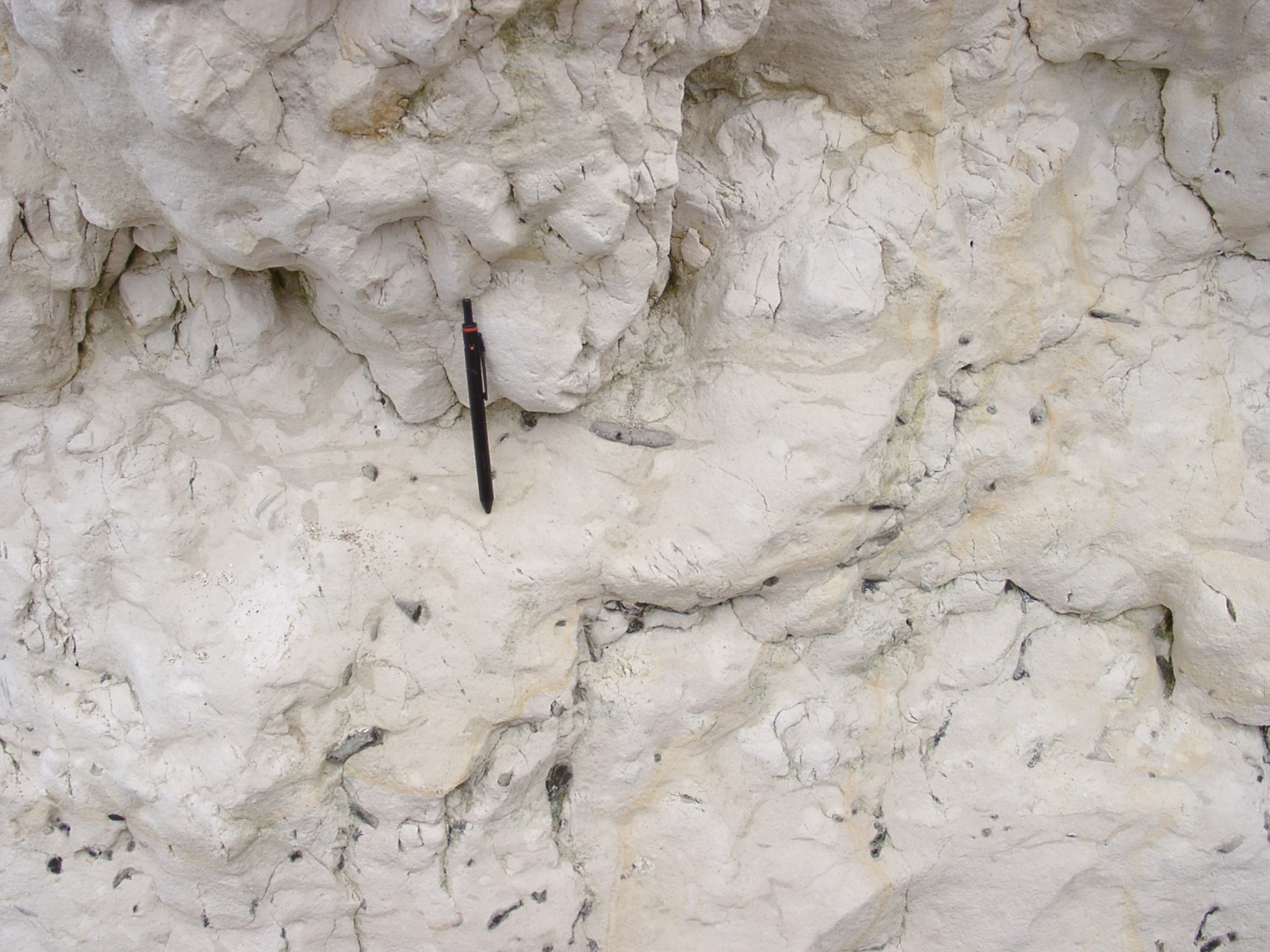 Detail of the chalk showing 'tiger-chalk' or 'Bšnderkreide' of the middle Turonian. |
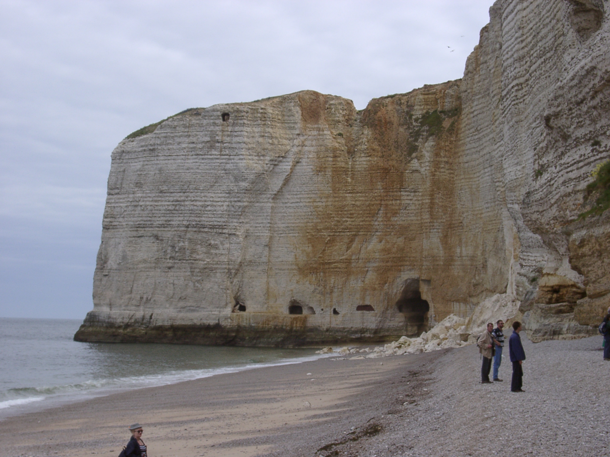 Western end of the beach below the Valleuse d' Antifer showing the Pointe the de la Courtine. Tunnels in the chalk are man-made and the large one to the right connects to the next bay. |
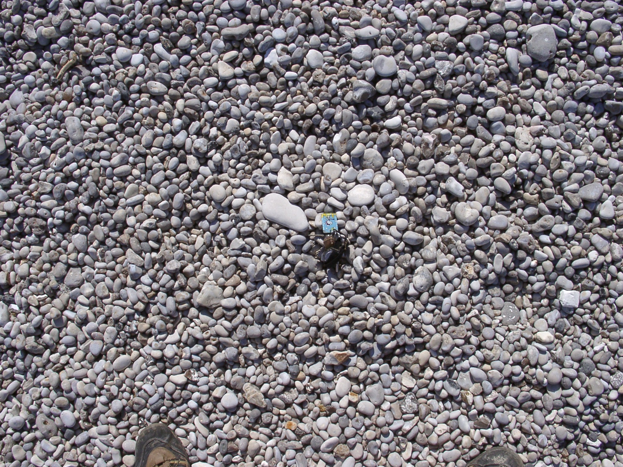 Typical surface cover of flint pebbles on the beach, keys for scale. Note the smootheness of the pebble surfaces. |